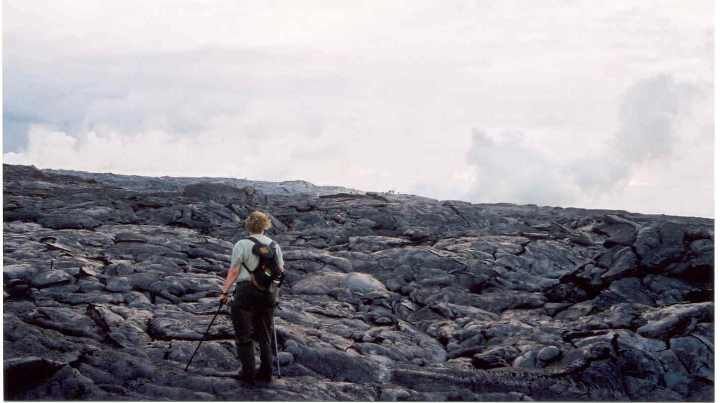
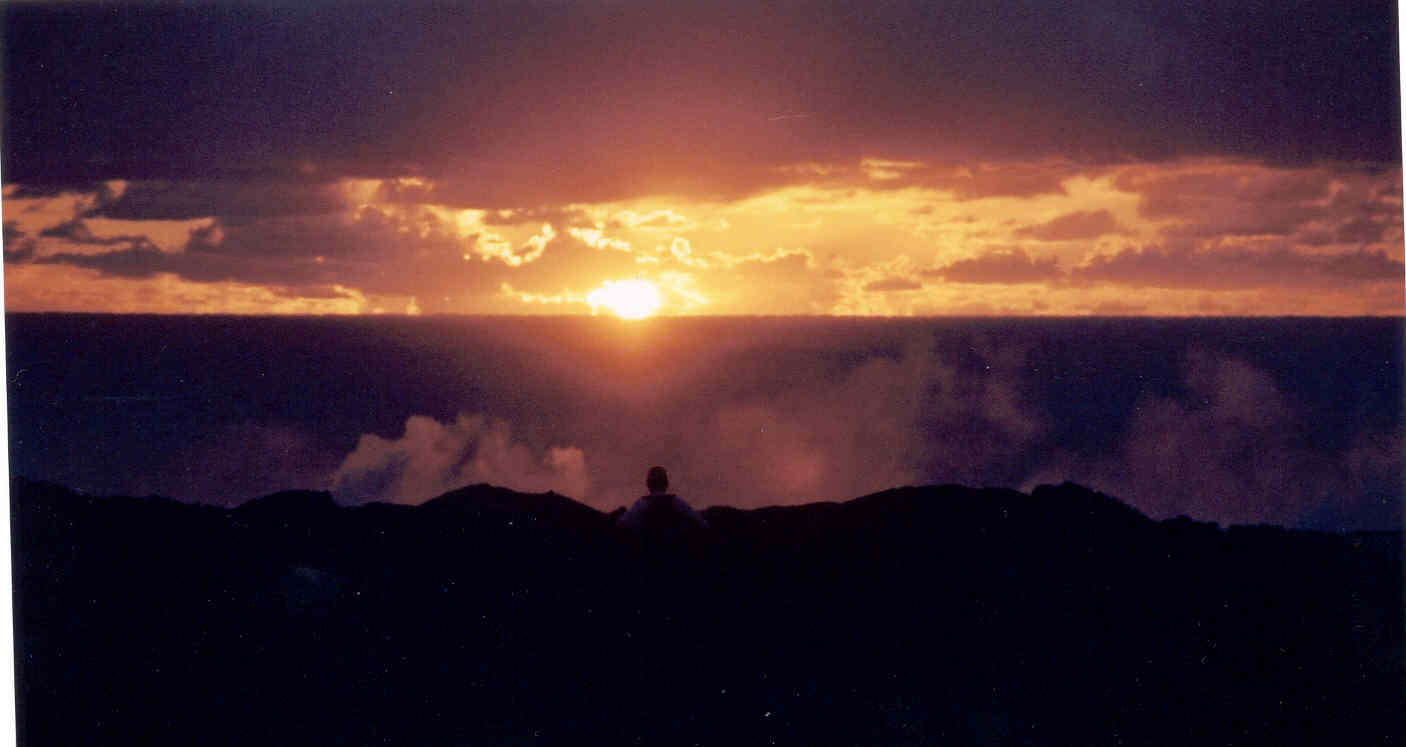
Here I am with two canes to steady me for lava clambering. You can barely
see steam clouds from lava entering the ocean. If you look REALLY hard,
you may be able to see people...tiny dots...on the horizon to my right. This was actually taken as we were leaving, after the sun had
come up; we've turned around to look back at where we had been. Imagine
what it was like trying to walk over this stuff in the dark!
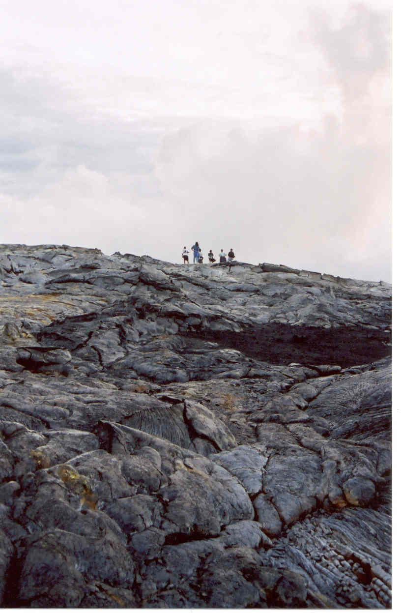
This is also taken as we were leaving, looking back at people still
standing at the vantage point for seeing lava enter the ocean. The shelly
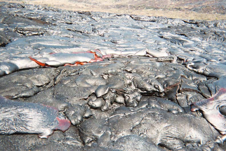
pahoehoe in the foreground shows how difficult the terrain is for the
casual walker. The brown and orange coloration is not vegetation; it is
staining or residue from fumarols. The ground is very warm.
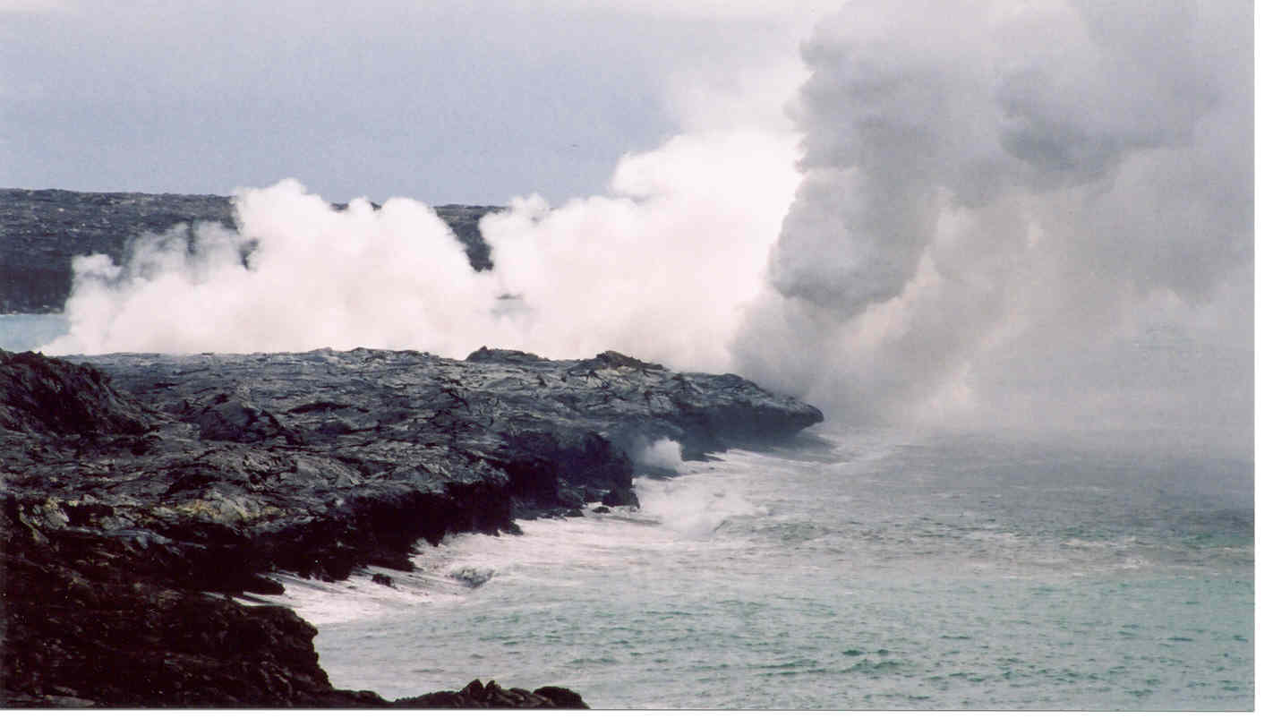
Steam from lava entering the ocean some distance away. This was taken
October 8 around 10 am
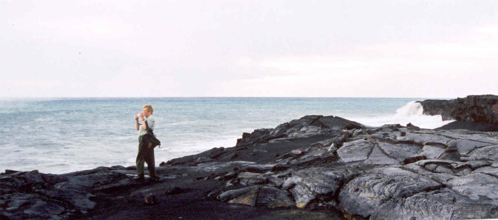
I'm standing on a patch of sand that was the beach the week before. Now it
is several metres above and inland from the present beach, seen in
background; scroll right.
Here's the real stuff! This was about 30 metres away, seen with a telephoto
lens. No tripod, so a little bit blurred. September 22, 5:30am.
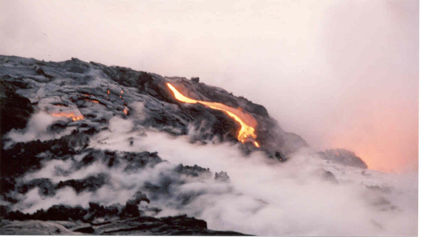
At dawn the action was easier to see, but not as spectacular as in the dark.
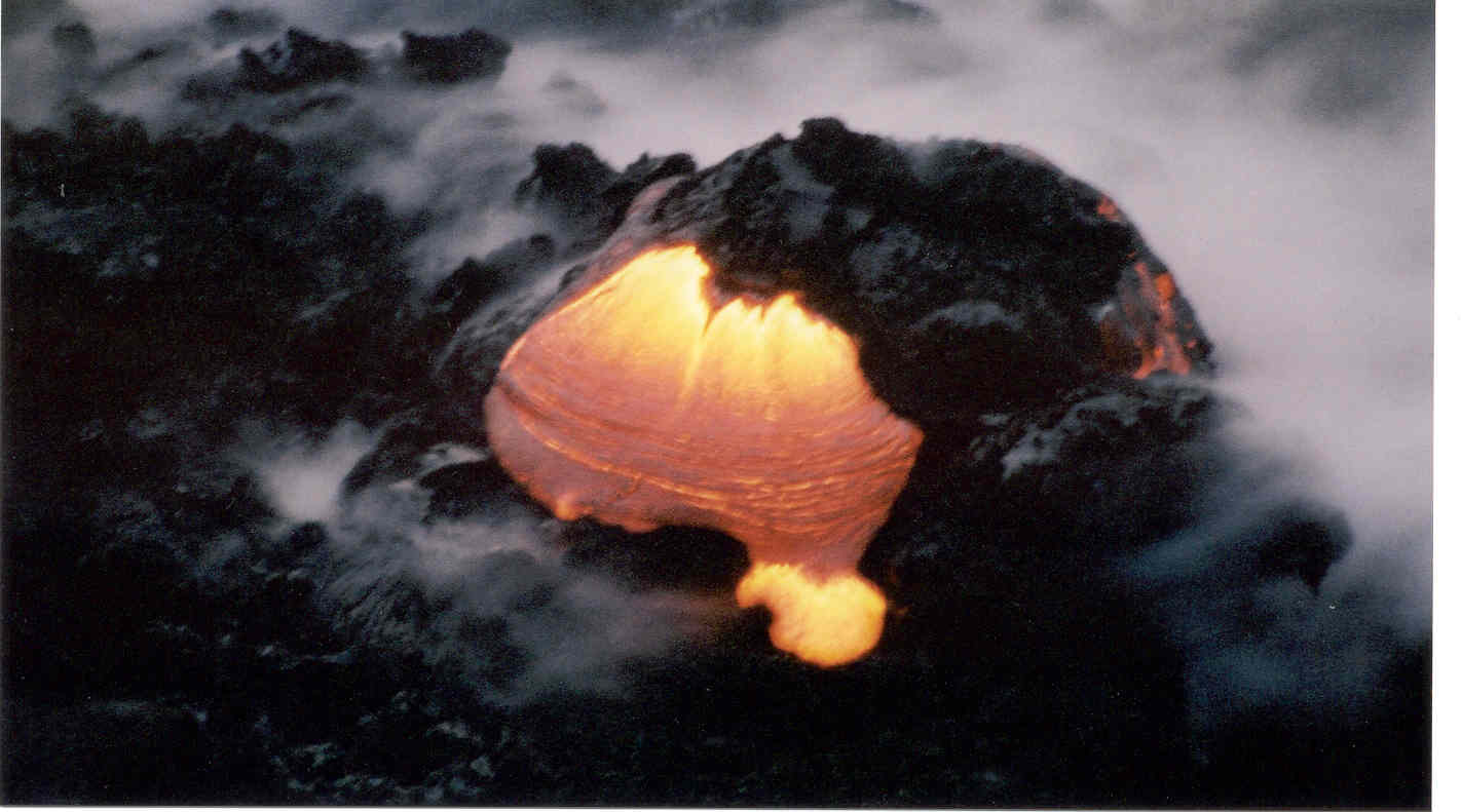
Here is a small dome and "toe," less than a metre wide, that formed on the
beach below...about 5 metres away from where we were standing. The waves
crashed over it now and then with a great sputter and cloud of steam, and
then it would emerge red as before.
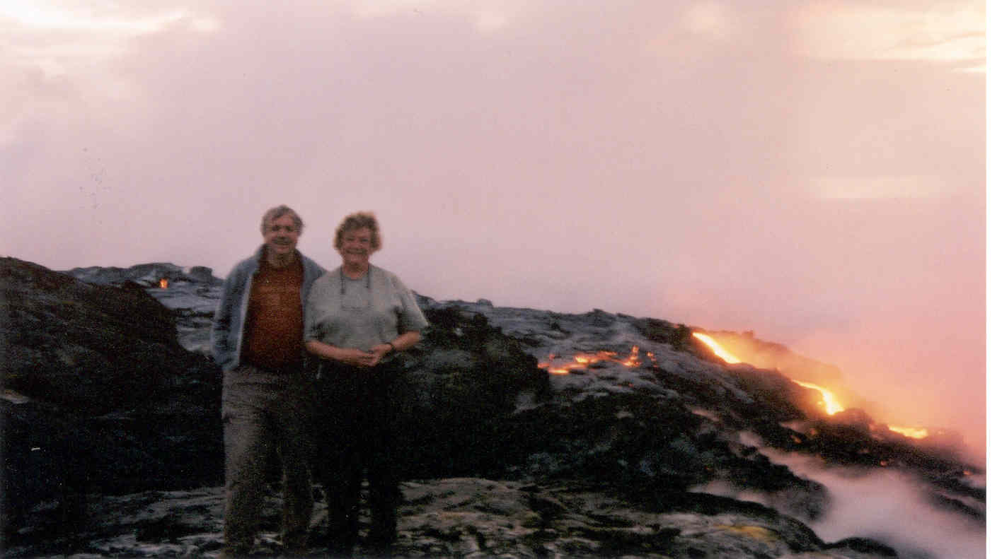
Here's the happy rockhound couple standing next to their friendly
neighborhood lava flow, 6:00am 29 September 2002.
Sunrise with laze (lava haze) 29 September 2002.
Hi all,
September 17:Ā I just got back from a drive to see the lava going in the ocean. I wasn't too hopeful I'd see a lot because my bad knees prevent much hiking, but I'd read that the lava has gone across the road just a short distance from the place they allow cars to park, so I thought I could at least see that. And it worked out just like that. I couldn't see any red lava. But the sight of the road with lava blocking it was impressive. If you look at yesterday's report (Sept. 16) at the USGS site, ( http://hvo.wr.usgs.gov/kilauea/update/main.html ) there's a picture showing the engulfed road. I walked right up to it, like the people in that picture,and it was still very hot. I could feel the heat radiating from it as if I were standing in front of the open door of a huge oven. I walked toward the place a couple hundred meters away where steam was billowing up indicating lava entering the ocean, as far as signs and barriers would allow. This did not provide a view of the actual lava. But I could see clouds of steam rising beyond a sea cliff, hear sputtering, smell the fumes, feel hot breeze, see the wavering visual distortion caused by heat rising, and every now and then a wave would crash into the cliff spraying white foam into the air.
As I left, a group of about 20 hikers who had emerged from a van from an "adventure tour" group marched vigorously right past the "Danger, Access Closed" signs and headed uphill away from the ocean. Apparently they had some special permission, or a lot of nerve (or were foolish?) and were going up to see the lava coming down the cliffs above. They may have also made it to a better vantage point to see the lava entering the sea.
What I saw was enough, however. I check the website every day and am constantly amazed by the excellent photos, and now I have the memory of the smell and sound and feel of being there to go with them.
Aloha, Kitty
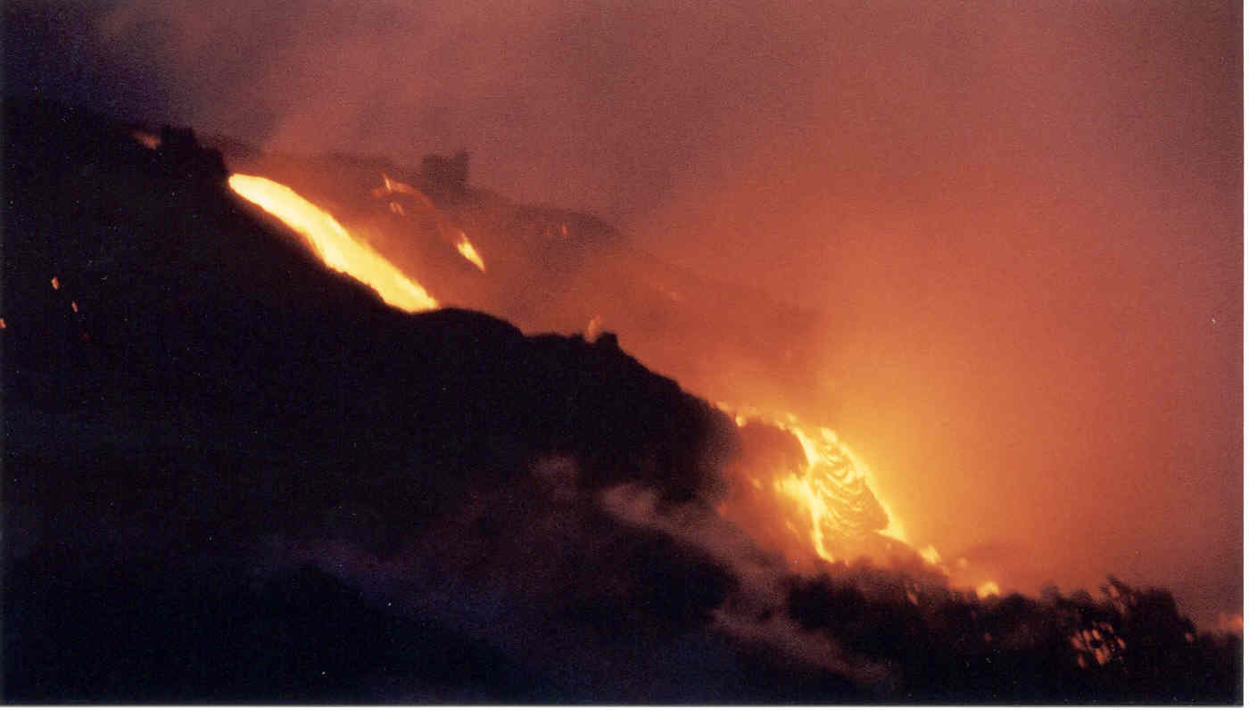
September 22: OK, folks, Bill and I took the occasion of harvest moon and autumnal equinox to go see the lava. We left the house at 4:00 this morning and got our first view from the top of Chain of Craters Road of red glowing clouds at the ocean cliffs about 5 miles away at 5:00 am. By 5:30 we were getting out of the car with sulfur-smelling vog swirling around us. As we walked towards the place where the lava created the latest road-block last week, we could see orange glowing spots above on our left as lava oozed down a pali (cliff) about 1000 meters away. Moonlight was bright enough that we didn't have to use flashlights as we walked along the road, but we could see lights from other hikers who were clambering cross-country both left up to the pali, and to our right to the sea. We elected to head for the ocean. Flashlights were indeed needed once we left the road, not to see the direction to go, but to pick reasonably safe surfaces to place our feet. Because of my bad knees I took a cane to help keep my balance. Bill---even though he has an artificial hip---had no difficulty staying upright and clambering everywhere; I think he was a mountain goat in a previous life.
There were maybe 20 other people scattered about the area, some picking their way closer to the glowing clouds of steam, others perched on tall mounds of old lava just gazing at the sight. Some were foolishly wearing shorts and flip-flop slippers, while others had full hiking gear and face masks for fume protection. We were somewhere in between. For some reason when people spoke they did so in soft voices, almost out of reverence for the magnificent event we were experiencing.
Soon we realized that bits of vegetation and dust and dirt were no longer beneath our feet, and we were walking on a new flow. I reached down and felt the stuff I was standing on; it was quite warm. The sky began to lighten a bit, and our eyes were adjusting to the light, so flashlights were no longer needed. The flow we were on is what they call "shelly pahoehoe" which is smooth and ropey, but with some flaky surfaces that peel off, and lots of cracks and tilted chunks. At a fairly level spot I decided to stop because the terrain between there and the lava was more broken and would require too much climbing for my knees. My agile husband scampered ahead.
I stood still and absorbed the sights and sounds. Moonlight shone off the cool lava giving it a silver sheen, and made sparkles on the ocean. Orange hot lava patches shimmered in the black cliffs in the distance. Steam clouds billowed from the sea in various tones of yellow, orange, red and magenta. A cool fresh breeze floated down from the hills, but occasionally the wind would shift to bring a blast of heat and fumes from the lava, and my throat and eyes would sting. There was the sound of surf crashing on rocks and an occasional moan as it slid across new black sand. Every now and then I could hear hissing and sputtering from the red clouds ahead as I could imagine lava hitting water. And there was the "plink" and "tunk" that periodically came from within the lava beneath my feet. As a potter I know that sound. It sounded just like a large piece of pottery after it's been removed from a kiln; it can continue to "plink" even after it is cool to the touch. This lava was not cool to the touch, though. My feet were getting quite warm through the soles of my boots, and I found I could see red glowing from a crack right next to me!
Then I heard an excited (but soft) "Ohhhh" from some people nearby, and saw a bright yellow-orange spot appear in the black field to the left of the ocean cliff a couple hundred meters away. It was a "skylight" that opened like a mouth yawning, revealing lava flowing rapidly beneath, and then, yawn finished, it closed. After about 15 or 20 minutes Bill returned. I had seen him join 3 or 4 people on a vantage point in the distance, maybe 300 meters away, silhouetted against the brilliant steam clouds. He said he saw (and took pictures of) lava oozing over a ledge like drool from a bulldog's chin. He said yellow drips would splatter into the ocean and waves would spit them as dark red and black rocks back onto the newly created black sand beach where they would rest and steam. I pointed to the red glow in the crack near me, and he said, "Oh yeah. I was jumping over big red cracks all over the place out there!"
Just then another soft "Ohhhh" from visitors, and we saw the sun coming up, at first a dark red semicircle through the vog, then creating a classic sunrise with brilliant colors across the sky and an army of cumulus clouds lined up along the horizon.
If you go to the following sites and scroll to the dates given, you'll see things very similar to what we saw. Clicking them to "large" is worthwhile.
http://hvo.wr.usgs.gov/kilauea/update/archive/2002/Sep/2-13.html September 8 (steaming rocks)
http://hvo.wr.usgs.gov/kilauea/update/archive/2002/Jul/19-31.html July 25 (moonlight)
http://hvo.wr.usgs.gov/kilauea/update/archive/2002/Aug/19-25.html August 20 & 22 (sunrise)
We got home at 8am and whipped up an omelette, hash browns and fried tomatoes and mushrooms for breakfast; visiting a friendly volcano creates an appetite!
Aloha, Kitty
September 29: Here╣s yet another lava report. Sorry it╣s so long and hope it╣s not too boring.Ā Anyone 60 years or older, or with physical disabilities, will appreciate this: I╣ve had surgery on both knees, and Bill has had restorative surgery on one hip and hip replacement on the other side. We are 60. With these limitations it was probably foolhardy of us, but we decided to make another go at seeing the lava going into the ocean yesterday morning.
Again we left home at 4am and arrived at the end of Chain of Craters Road at about 5:30. There were at least a half dozen spots in the cliffs and higherground above the road where red-orange lava could be seen breaking to the surface in the dark, and towards the ocean were plumes of red steam clouds where lava was entering the sea. We waited a few minutes to let our eyes adjust to the dark, and then took off for the red steam clouds. The │shelly pahoehoe▓ makes for unsteady footing because little slices (a bit like clam shells) of smooth lava tend to slide and crumble underfoot. The lava which originally formed a variety of uneven, ropy configurations, and cooled with many cracks and crevices, had then been broken into large chunks and tilted by subsequent flows, forming a landscape that is fascinating, confusing, and nightmarish in appearance, especially in the dark (and for someone with walking difficulties)! But with canes and walking sticks we made it to the shore. We walked on a black sand beach that still hissed when the waves slid up it, and puffs of steam exuded from cracks at its edge. There were a few people standing on a small cliff above the surf, silhouetted against great puffs of red and orange steam, and we climbed towards them. After moving quickly across a strip of lava that was really very hot, we reached the vantage point. On the other side of the group of people was a tongue of lava pouring over a small black mound into the water just 8 or 10 meters away. The mound was about a meter tall, and a wave crashed and covered it briefly; a cloud of steam arose with hissing and popping sounds. As the steam blew away it appeared for a moment that everything was black, but then the yellow-orange lava burst forth again and poured onto the beach. Then a │toe▓ opened up closer to usŖmaybe three meters away. It swelled and became an orange, dome-shaped lump, stretching and bulging, and gave out with a huge │PUMPF▓ when a wave crashed upon it. Small pieces of lava exploded and slid as orange blobs into the water, coming back moments later as dark red and black rocks. The breeze changed and blew the steam clouds and fumes over us, and everyone began coughing. Bill and I had brought damp cloths with us, which we held over our faces, and this was a great help.
There was camaraderie among the people there. We handed cameras to each other to take pictures. When a man slipped and fell down we all fussed over him with great concern, though it was obvious right away that he was fine. Voices were hushed, almost out of respect, even though wind and steam and surf put up a constant competing noiseŖpeople stepped closer to each other to talk, rather than shout. One man---wearing a tank top, shorts, and rubber slippers---had an expensive camera with a large zoom lens, but did not have a camera bag or case, nor a lens cap; not even a protective filter on the lens!Ā He happily trotted off over new lava to get closer to the flow, through clouds of fumes; a chunk of stuff broke off the cliff he was standing on, and he laughedŖbut turned back to safer territory.
The sun came up, and we headed back. In the daylight we could observemore details. Some large cracks had yellow (sulfur?) powdery coverings along the edges. Some cracks were emitting puffs of steam, and others were glowing red deep inside. There was a place where a smooth, iridescent surface maybe two square meters in area, had three small chunks of lava perched on top; two were firmly attached to the smooth layer beneath, but the third tumbled down the slope in the breeze. We guessed that the chunks were from an explosion and when they landed, either the chunks or the smooth surface were still hot enough that two of them became glued in place. The chunks looked like pieces of natural sponge, full of holes, but were so sharp that when I reached down to touch one lightly, my finger came back with a tiny dot of blood from a prick. We found a patch of black sand, maybe three meters square, which must have been formed only a day or two ago at the ocean╣s edge, but was now several meters inland and above where the beach is now.
BTW: The volcano experts here began announcing over the weekend that Mauna Loa is inflating and may show activity soon. It is overdue, as the last eruption there was 18 years ago. Bill remembers looking over at that flow from the university telescope when he was observing on Mauna Kea, and everyone in Hilo could see the lava glowing above the city at night.
Here again is the USGS website:
http://hvo.wr.usgs.gov/kilauea/update/main.html
It is definitely worth clicking on "large" to see full-screen photos, and going to "Image Archives" for photos from the past. For beautiful lava and sunrises, try 6 January and 20, 21 and 22 August. For some bizarre images, check out: 2 August, 2nd picture...a lava Cookie Monster or Jabba the Hut. 30 July, 4 pics of a biting monster. 26 July, 1st 3 pics of a drooling sea creature. 25 January, last picture for that date, is captioned "Close-up of a knuckle handshake between 2 glowering towers," but it reminds me of a grotesque version of Michelangelo's "God Creating Adam." 19 August, "Head-on view of tiny stair-climber" looks like a snake lifting its head to decide where to go next. 3 September, 7th picture, an angry black god emerging from the Underworld.
Aloha, Kitty
Last winter one of my wife's brothers contacted us about having a family reunion in Hawai`i, offering to provide lodging via some timeshare magic if we would provide transportation. We said YES!, made flight arrangements, and I contacted Kitty and Bill Heacox offlist about collecting in the islands. Many messages later we accepted their most kind offer to spend some time with them and modified our travel arrangements. This is a (field) trip report of our just completed visit to the beautiful island state in the Pacific.
Our first week was spent with family on the oldest of the islands, Kaua`i. Some of the family then spent a second week on Maui (that had been discussed as the original destination), but we went on to the newest island, Hawai`i, to visit with Kitty and Bill.
The Hawaiian islands are the result of a plume or hotspot bringing magma up from deep in the earth's mantle forming a shield volcano. As the surface plates have moved over the hotspot a series of islands have formed. Hawai`i is the newest of the islands, but there is a new one forming, called Loihi, that is expected to reach the ocean surface in another 5,000 years or so.
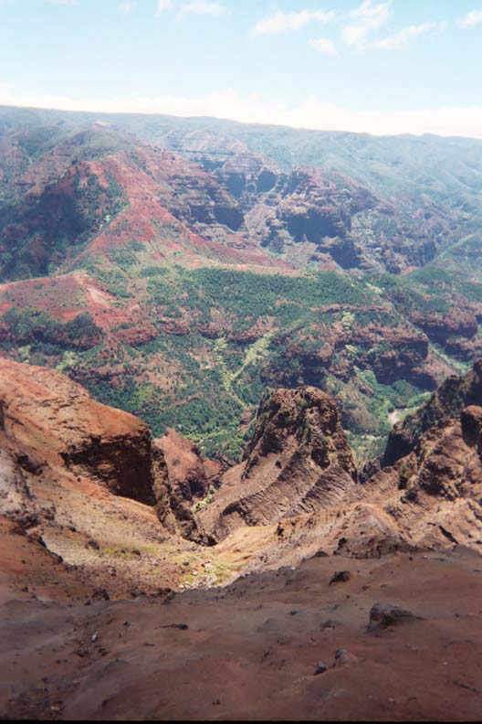
Kaua`i is 3 to 5 million years old, and has eroded significantly from its original size, which was probably about as big as Hawai`i is today. The last volcanic eruptions on this island were around 400,000 years ago. There is strong evidence that there were at least two shield volcanos that produced the island, but the central Olokele member is usually claimed to be the single shield volcano that produced the island. Here are a couple pictures of the Olokele caldera taken from our helecoptor tour (you can click on them for bigger images).


A shield volcano starts out producing alkalic basalt (1%), then produces theoliitic basalt (97%), then post shield alkalic basalts (1%), and finishes with rejuvenated alkalic basalts (1%), which tend to be highly fluid. Hawai`i is in the last stage currently. BTW, when measured from the ocean floor the Hawaiian volcano's are taller than Mt. Everest (measured from sea level).
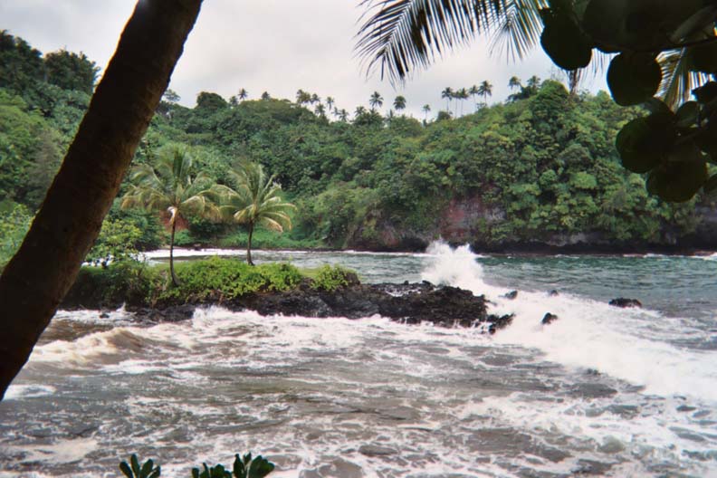
Our first full day on Kaua`i we went on a sea cruise from the south side of the island with Captain Andy, around the west side, and went snorkeling along the Na Pali Coast. At one point we came across a group of 8 giant sea turtles (but I only managed to get a picture of one). Sunset was unusually clear and we saw the 'green flash'. Many rainbows were seen, including a beautiful double; we saw at least one rainbow every day on the islands.


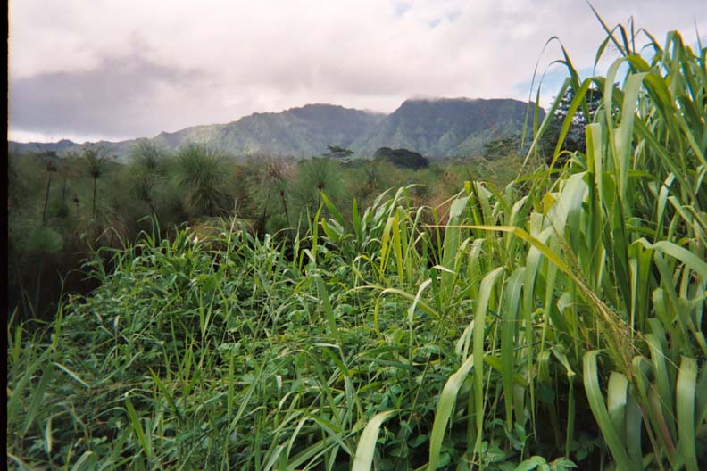
The next day we hiked thru an interior tropical forest inland from Kapa`a. I collected some sedimentary mudstone composed of the brown volcanic 'dirt' that is characteristic of the island. I would add that the 'dirt' on Kaua`i stains so well it is actually used as a dye for cloth. Welcome to the rain forest...


The next day we hiked part of the Na Pali Coast and I collected some beautiful olivine. We swam at Hanakapi`ai Beach

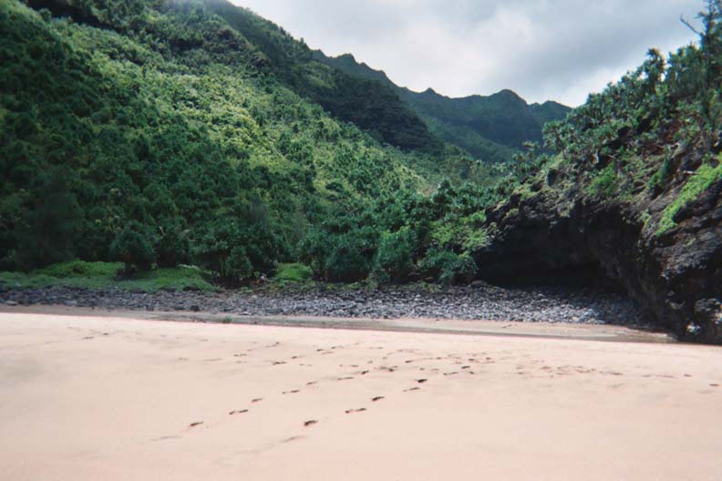
before our hike back out. Take lots of water and be prepared for some rugged terrain. You also need to be prepared for some beautiful views.


The next day we took a helecopter tour of the island and interior, including Wai`ale`ale, which is claimed to be the wettest spot on earth, receiving between 400 and 650 inches of rain annually. On the dry side of the island we saw cactus. The contrasts on the island are truely remarkable.
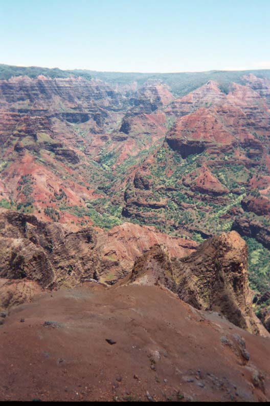
On our last full day we went collecting on Waipouli Beach and found some beautiful corals that had washed up (they are now in our fish tank). We continued around the island to a coffee plantation, and then on to visit Waimea Canyon, which is even more spectacular from the ground than it was from the air. A view of the Grand Canyon of the Pacific...


We then went swimming and collected shells at Barking Sands. Returning around the island we went to a luau at Kilohana.
We stayed in Princeville and found time for family fun too; many of our outings included others in the family. I found a rock shop in Hanalei (off the parking lot behind the Hammock Shop on the main drive; it is near to the breakfast restaurant and internet cafe) and purchased some beautiful calcite crystals on matrix that came from a coral/limestone quarry in Po`ipu. I mailed three boxes of what I had collected home before we went off to Hawai`i.
Kitty and Bill quickly made us feel like family and old friends, and we found much to talk about during our visit, which turned out to be way too short. I wish Kitty and Bill were my neighbors.
Our trip to Waipi`o Valley involved (required!!!) 4 wheel drive as the road down approaches a 45 degree grade; I was glad Kitty was driving because she had been there before. The valley was amazing and I collected some black sand from the beautiful beach. It would have been easy to turn this visit into a day of lazy vacation on the beach and further exploration of the long valley.


On the way to Waipi`o Valley we stopped at the Hawaii Train Museum near Laupahoehoe Point (where we did some collecting).


Trains played a very important part in the history of the islands. I noted a number of old roadbeds during our travels and wished we had time to hike them and collect. I was glad we stopped and wished we could have spent more time there as I learned a lot of history.
On the way to Waipi`o Valley we also passed the Hawai`i Tropical Botanical Gardens (and stopped at their gift shop to pick up an extra disposable camera). Monica and I later want back to this amazing place and spent a half day enjoying thousands of tropical plants (including a palm jungle, orchids, and one of the prettiest coastlines we saw during the entire trip) in an incredible rain forest setting; I'm sure we missed more than we saw. We even had the chance pleasure of meeting the owners of this labor of love. If you are ever near Hilo, take time from collecting to visit this beautiful place.


Earler on this page I have a trip report from Kitty and Bill about their trip to where Kilauea was spilling red pahoehoe (and a`a) into the ocean and noted that "I wish I could have joined Kitty & Bill Heacox for this trip in Hawaii!". Bill had to work, but it was truely a great pleasure to take a similar trip with Kitty to this location! That's Kilauea behind Kitty and Monica.

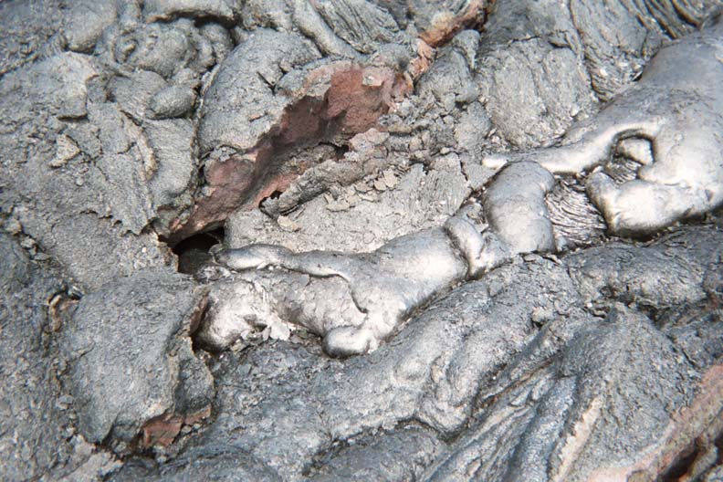
We didn't see lava pouring into the ocean (or anything red), but we did get to walk on fresh (and very hot!!!!) lava that was still cooling, venting, and 'clinking' as it cooled. I even got my picture taken.

We had strayed off the path trying to find red lava using the heat shimmers as a guide, and finally decided we were in over our heads and needed to turn around because it was getting unsafe. This was the area where the lava had gone over the road. The yellow markers show the type of trail the Rangers had marked out.


We also went around the giant Kilauea Caldera. Note the offerings to Pele in the foreground.


that still has steaming fumaroles around it.

I collected some very interesting specimens of "unknowns" on basalt that I hope to identify someday, as well as pahoehoe and a`a. Pahoehoe is smooth and a'a is rough. Here you can see a'a surrounded by pahoehoe.

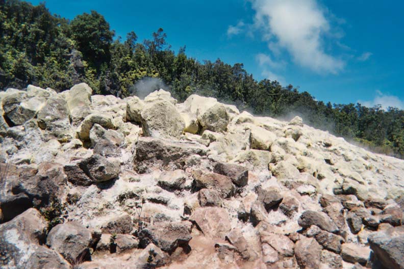
We also collected some (smelly) sulfur crystals (and some were green -- any suggestions of what they might be are most welcome) from vents. The sulfur crystals turned out to be fluorescent. Here is a giant sulfur fumarole near the small one in the road (it actually had tire tracks thru it) where we collected our sulfur.
We also visited the two rock shops on the island (where I purchased some specimens) and stopped at road cuts to do some collecting.
The other collecting trip I will never forget was on Mauna Kea with Bill. He needed to get some measurements of the oldest observatory on the peak for his job, and we turned the trip into a memory. The ancient Hawaiian's had a quarry around 12,000 ft where they mined very hard basalt (this stuff sings when struck -- you could make wind chimes from it) for use in making their stone age tools. On our way up to the peak (and observatories) we stopped to hike several hundred yards across very rough terrain to collect. I don't think I have ever worked harder to collect a specimen. There used to be glaciers at this location and we even found rock marked with glacial striae (did you know they have snow every year in Hawai'1?).


Walking at the peak was almost harder at nearly 14,000 ft. But the view of sunset, stars, full Moon, Centuri, and Mars, was worth any effort.


Getting inside a couple domes at the best observing site in the world was gravy at its best! That's Bill with Monica in the Control Room of the 88 inch telescope.


I may be a rockhound, but I like to look up too. Astronomers take Lapidary to extremes in making their mirrors and we can learn a lot from their practice of the grinding and polishing arts.
I spent a most enjoyable afternoon with Kitty and Bill's "unknowns" (while Monica worked in Kitty's garden, by choice) and made a little progress at identifying some of them. Kitty and Bill have a most amazing collection of fluorescent (and other) minerals, and it was a real pleasure to be able to see their collection. We also spent a very pleasurable evening with Kitty's brother and wife (and Kitty and Bill), and I think minerals only got a passing mention.
On our last day Kitty checked the USGS site early in the morning and found they had marked a new trail to 'red' lava from a new flow. We gave up going to the green sand beach, and Monica and I went back to Kilauea; we were able to get within a couple feet of red pahoehoe (by ignoring the Ranger's warnings and going about 10 meters off the marked trail). At one point I tossed a softball sized rock into the red stuff and it splashed and sank; the lava had the consistency of brownie mix.


I'm still kicking myself for not bringing my rock hammer (I thought I had done enough collecting a couple days earlier; I shipped another ten boxes of specimens home before leaving) so I could have scooped up some fresh red stuff -- now I need to go back!
I'm sure you have heard stories about Hawaii and its islands that are hard to believe; after visiting I can assure you that they are true! This has been the most enjoyable, and the best collecting vacation, my wife and I have taken in more than 25 years.
Mahalo Kitty and Bill!
Aloha,
Kreigh
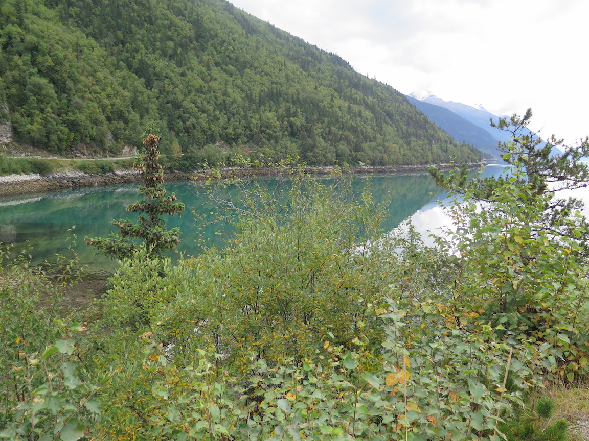
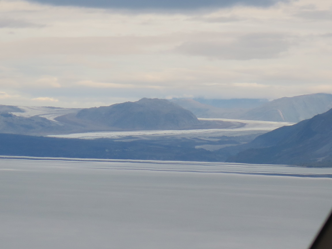
We had one of those wedding anniversaries this year ending with a zero and decided to take a trip to celebrate. Since I had already visited 49 states, it was a pretty easy sell to visit the 50th state, Alaska. Turned out to be a good choice. Our planning started about a year early. We used AAA for our travel agent, and booked a 'land and sea cruise' with Holland-America. We chose late in the season so we would have the best chance of seeing the northern lights. So off we go to Alaska, flying into Anchorage. Nearing the airport I get my first glimpse of a glacier out the plane window.
 After a night in the hotel, and some time to see the city, it is time to get on the
train and visit Denali.
After a night in the hotel, and some time to see the city, it is time to get on the
train and visit Denali.
 The special rail cars are designed for good viewing. We were lucky to have the first
car after the engine so it was easy to see what was coming up. Our train host kept up
a running dialog of what to watch for and the history of the area and the railroad.
The special rail cars are designed for good viewing. We were lucky to have the first
car after the engine so it was easy to see what was coming up. Our train host kept up
a running dialog of what to watch for and the history of the area and the railroad.

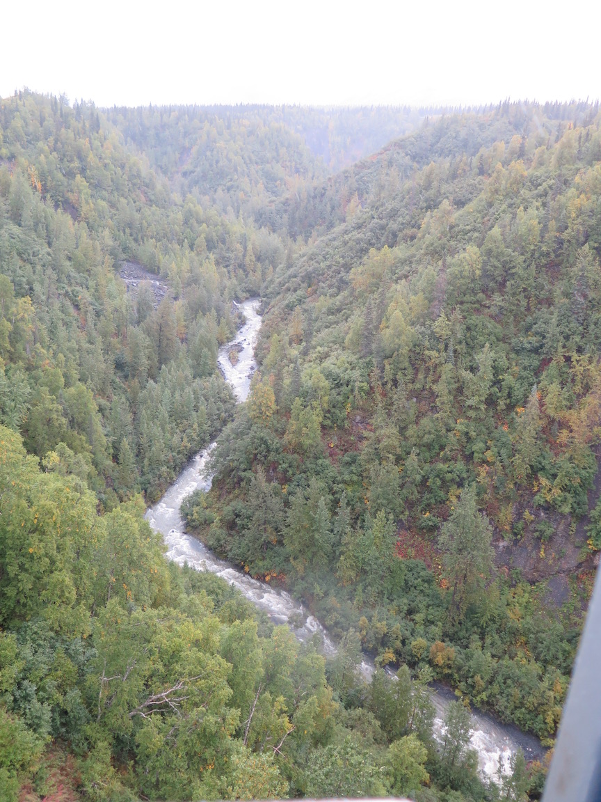
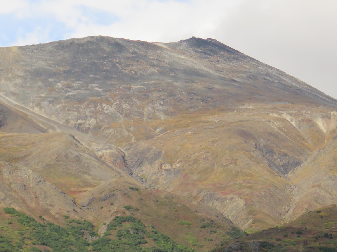
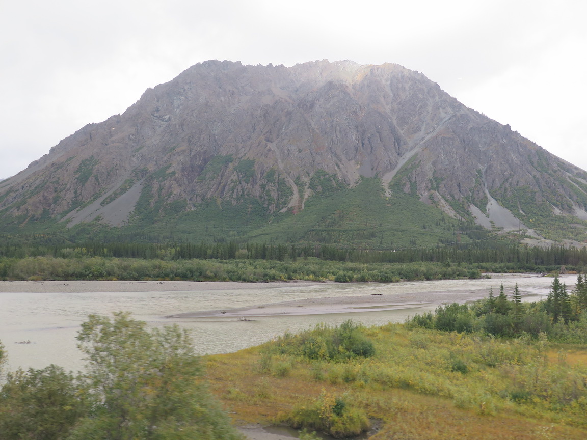
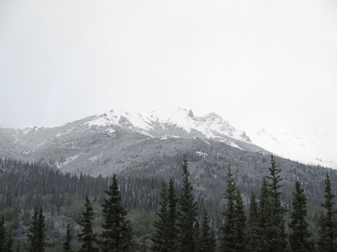
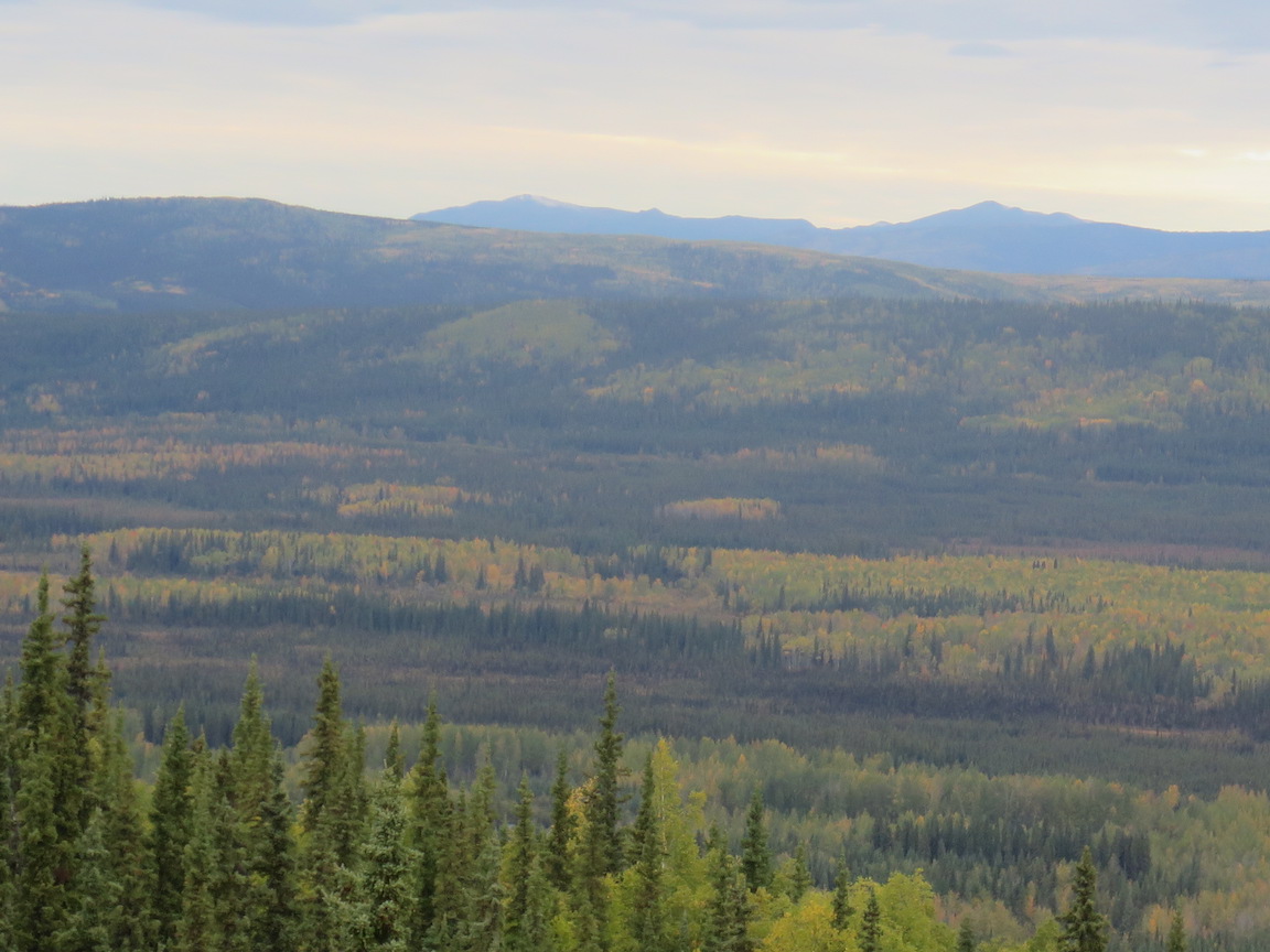
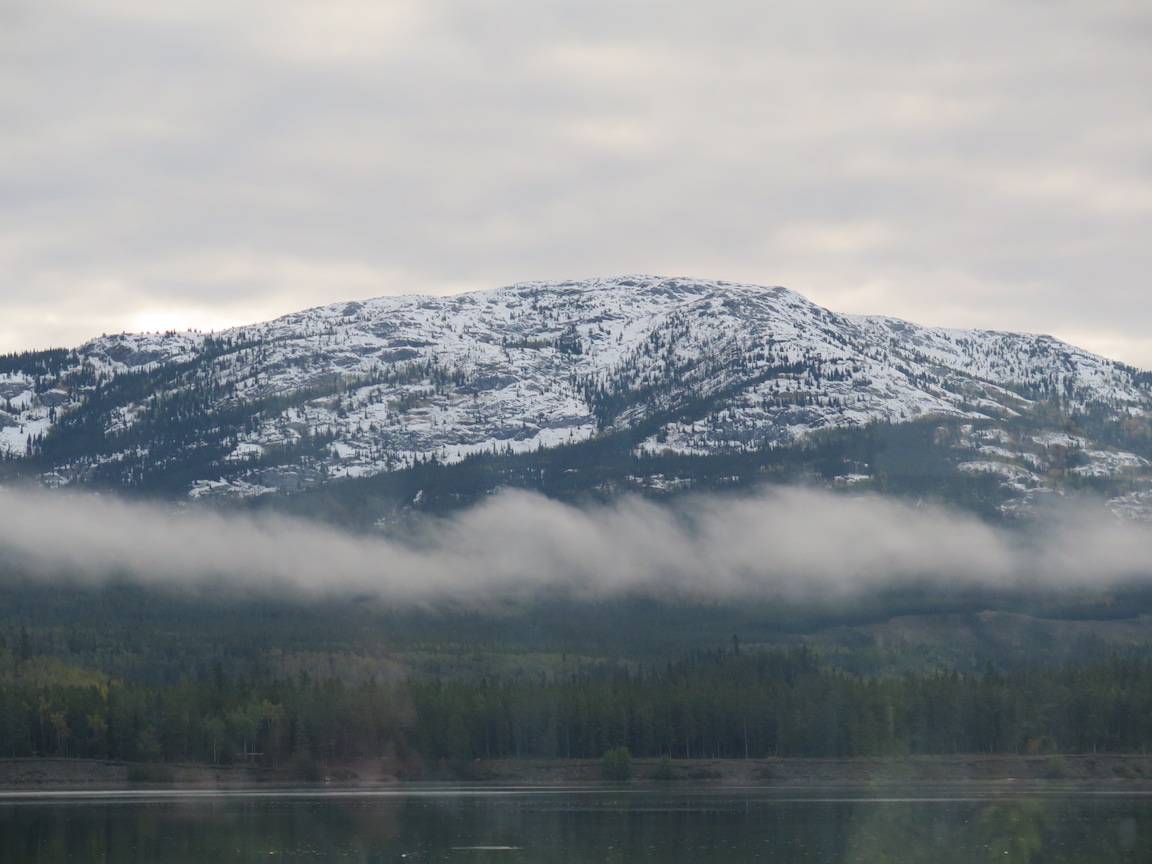
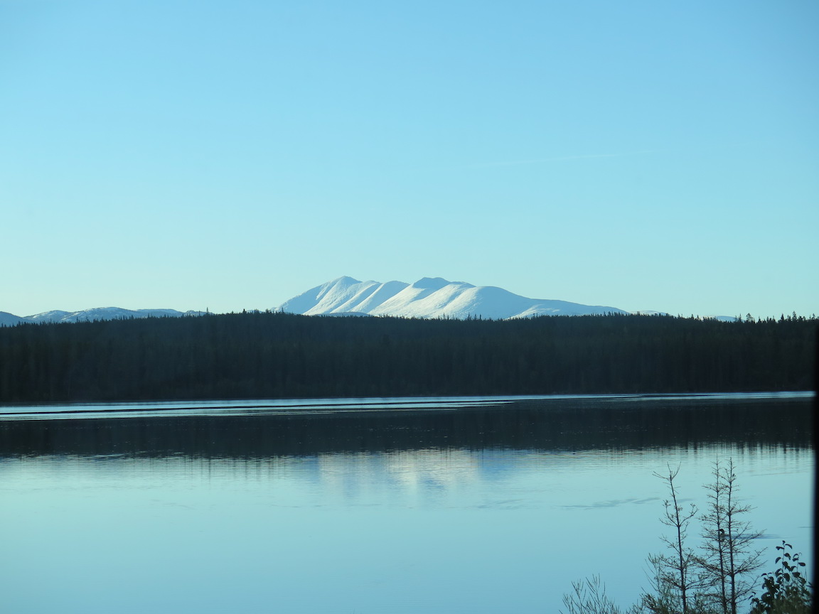
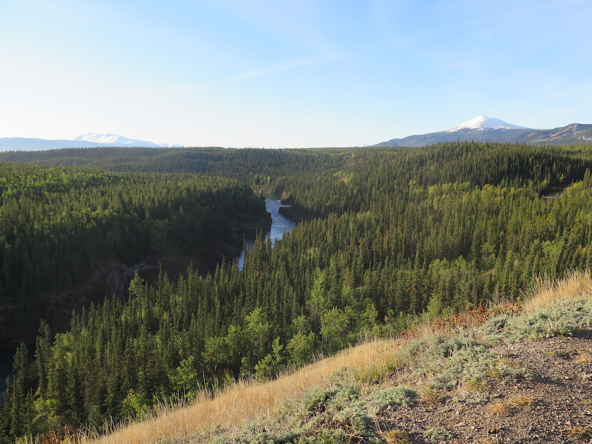
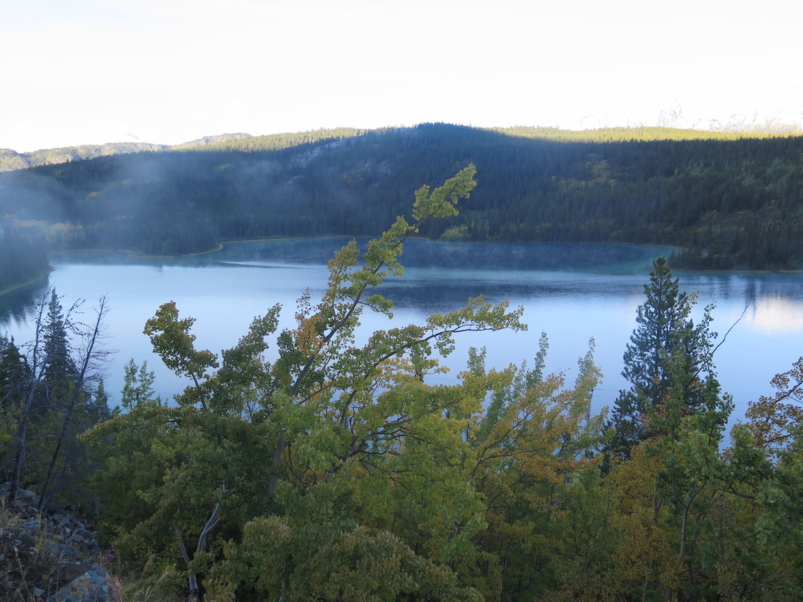
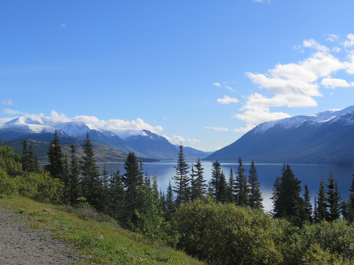
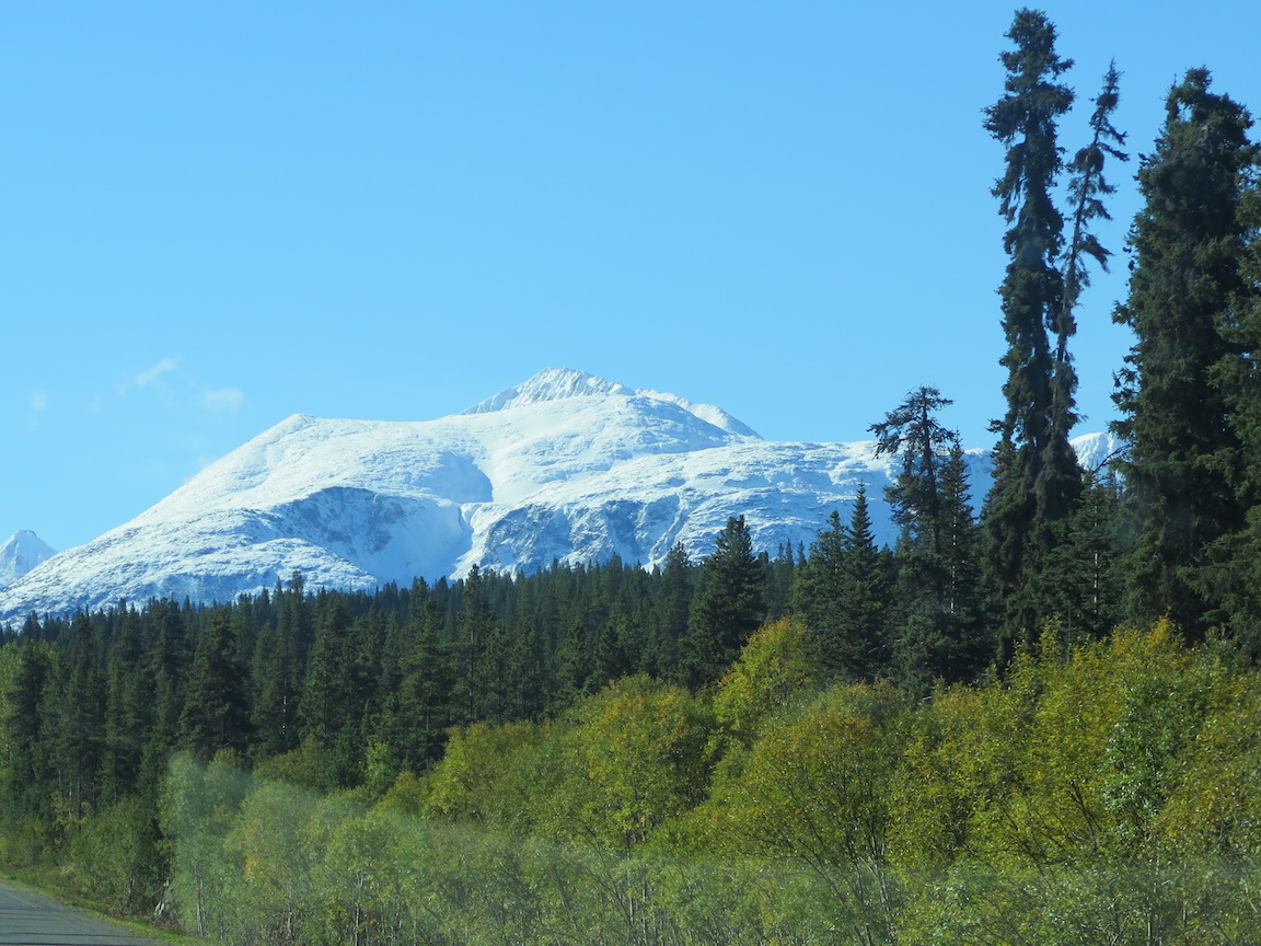
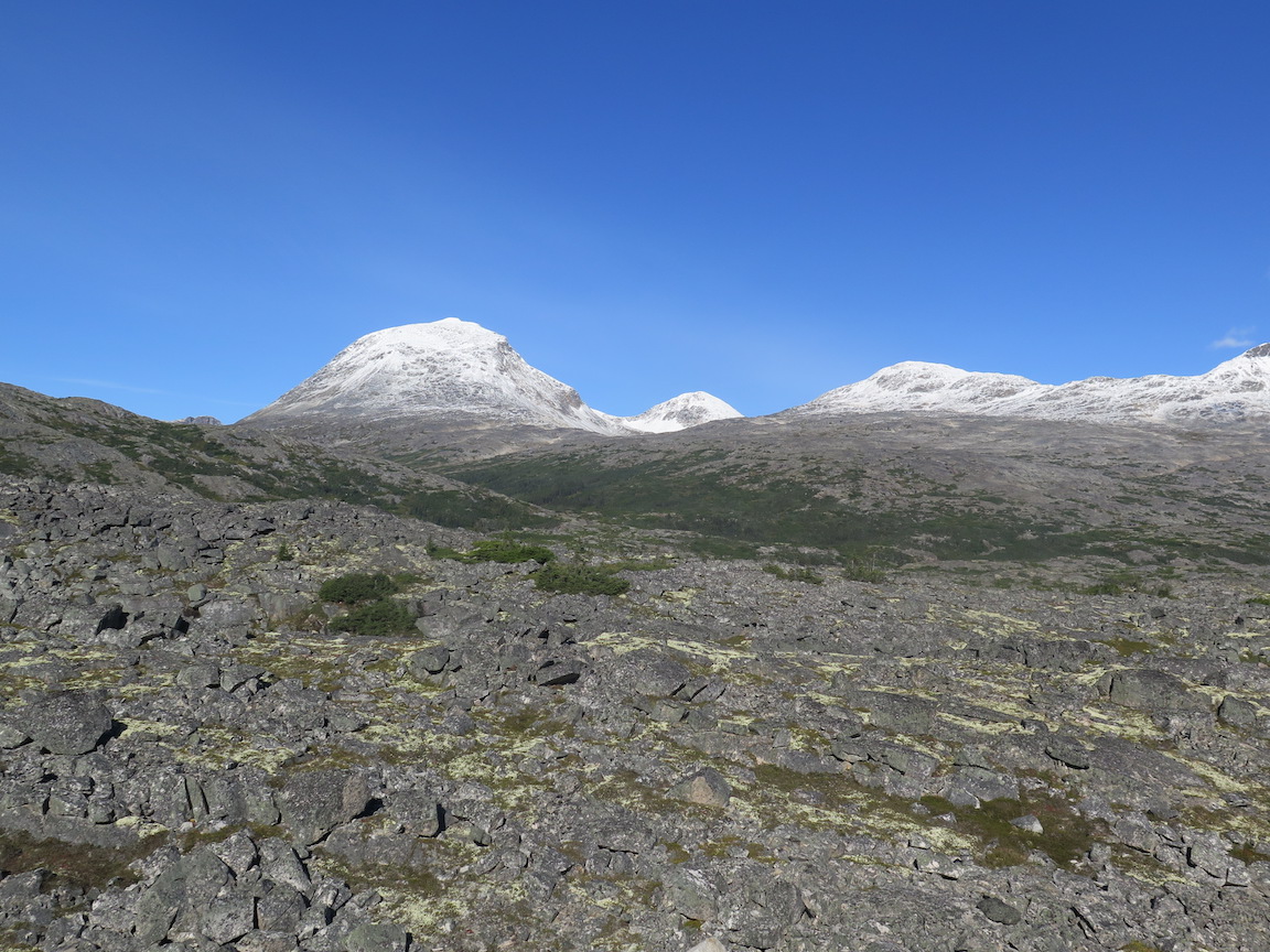
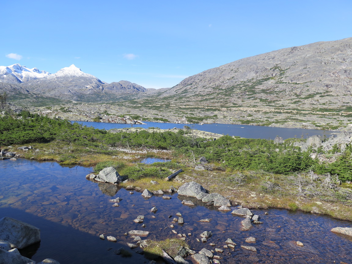
We got to see some pretty interesting terrain.


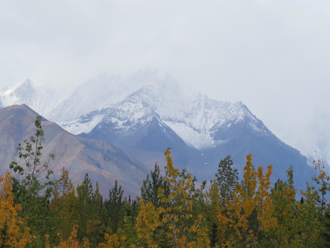
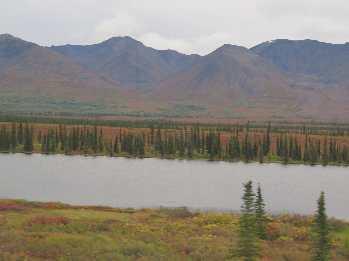


And we had arrived

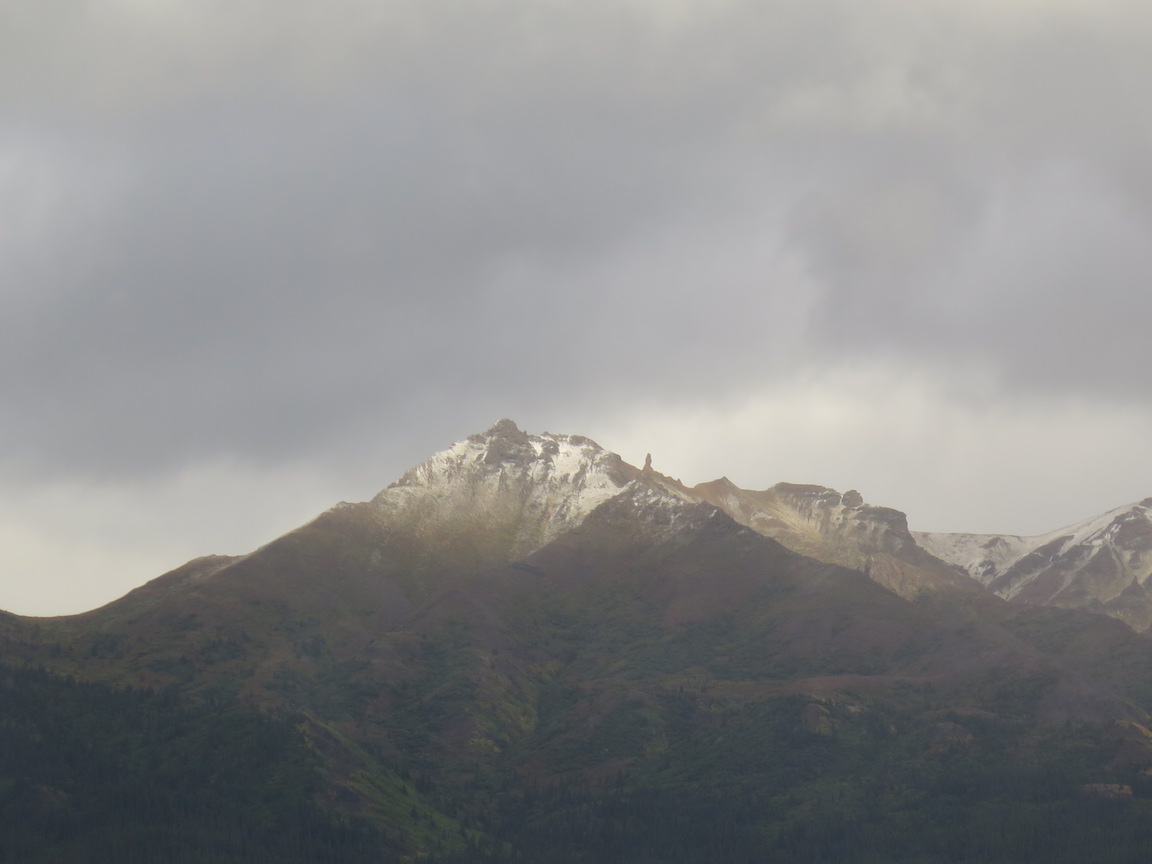
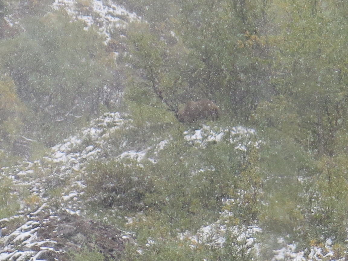
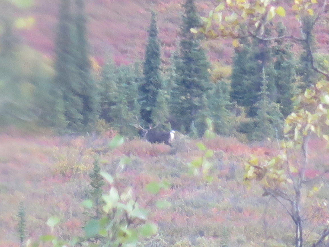
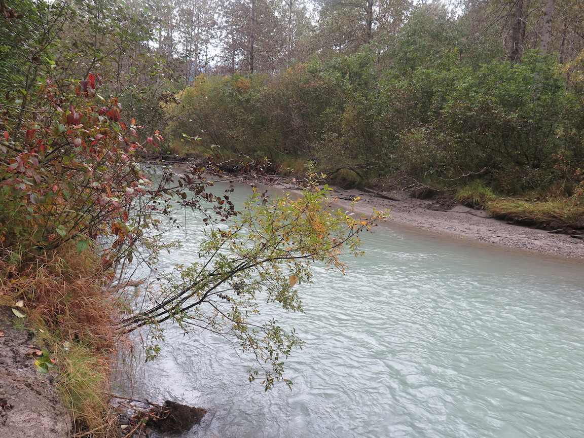
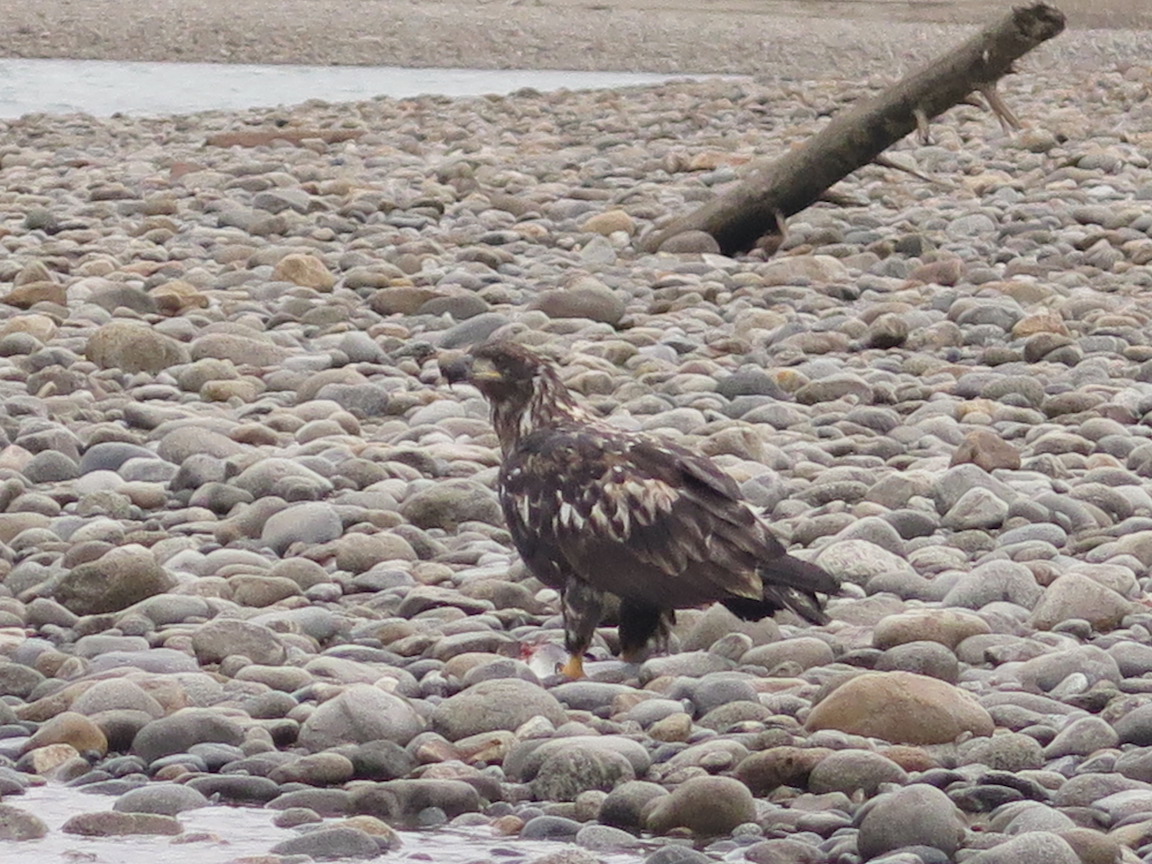
We spent three days at Denali. One day was a bus tour, and the other two days we hiked. We saw a lot of animals even though the weather was not the best.


And I even found a rock shop

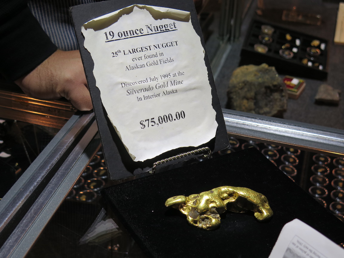
Then it was off to Fairbanks to see one of the gold dredges and go gold panning. The bus ride went thru some more beautiful scenery. We were on our own for lunch and ate at the local Parish after attending Mass. We even got to see the Alaska Pipeline. Yes, we found some gold, but they did not let me keep the big nugget.


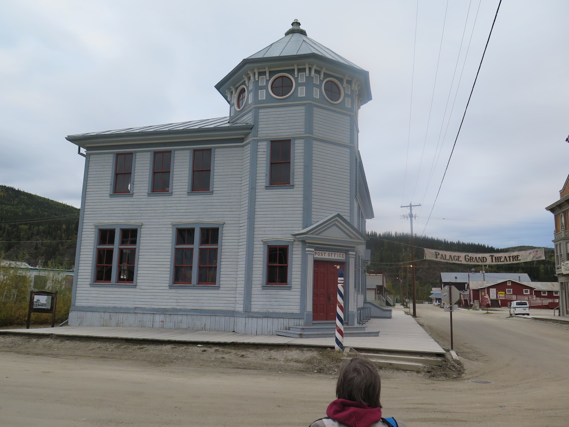
And then it was off to Dawson, in the Yukon. We finally got to see Denali from the
plane on the way.

Dawson has a gravel runway that has to be graded daily after use. Landing on a gravel runway has a very different feel than the normal airport. Then we had to go thru Canadian customs. The streets in Dawson were gravel, with boardwalks. They were even grading them while we were there


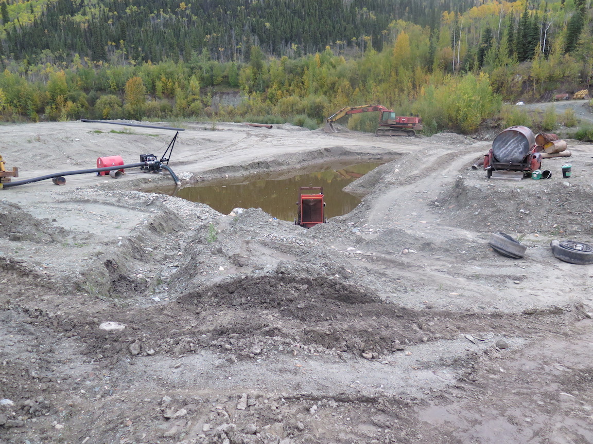
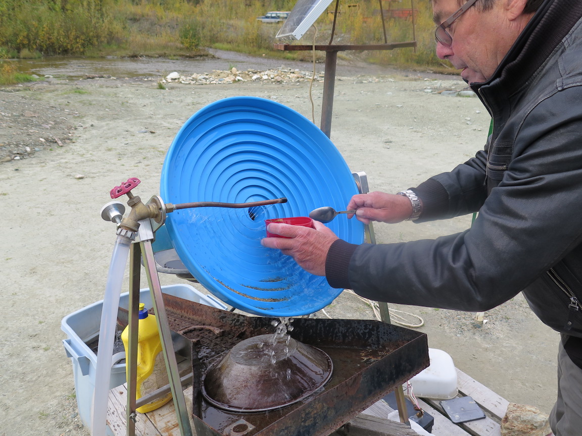
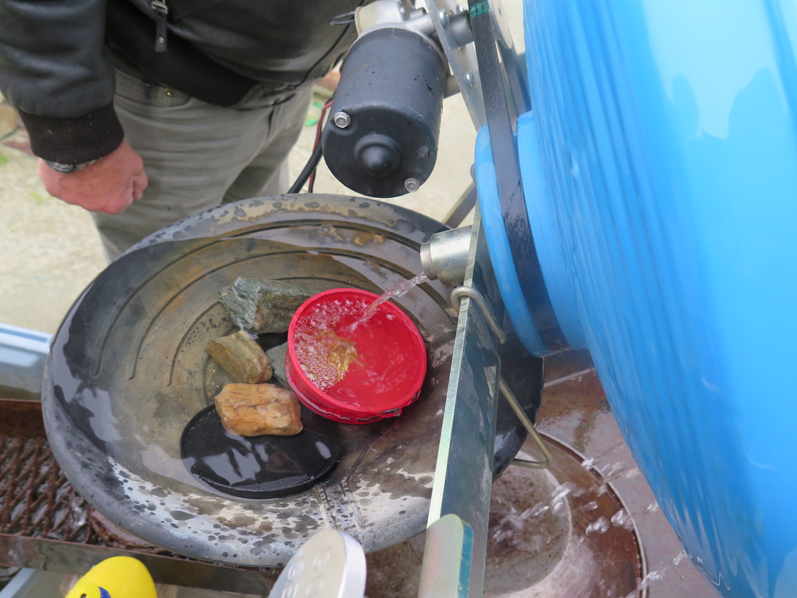
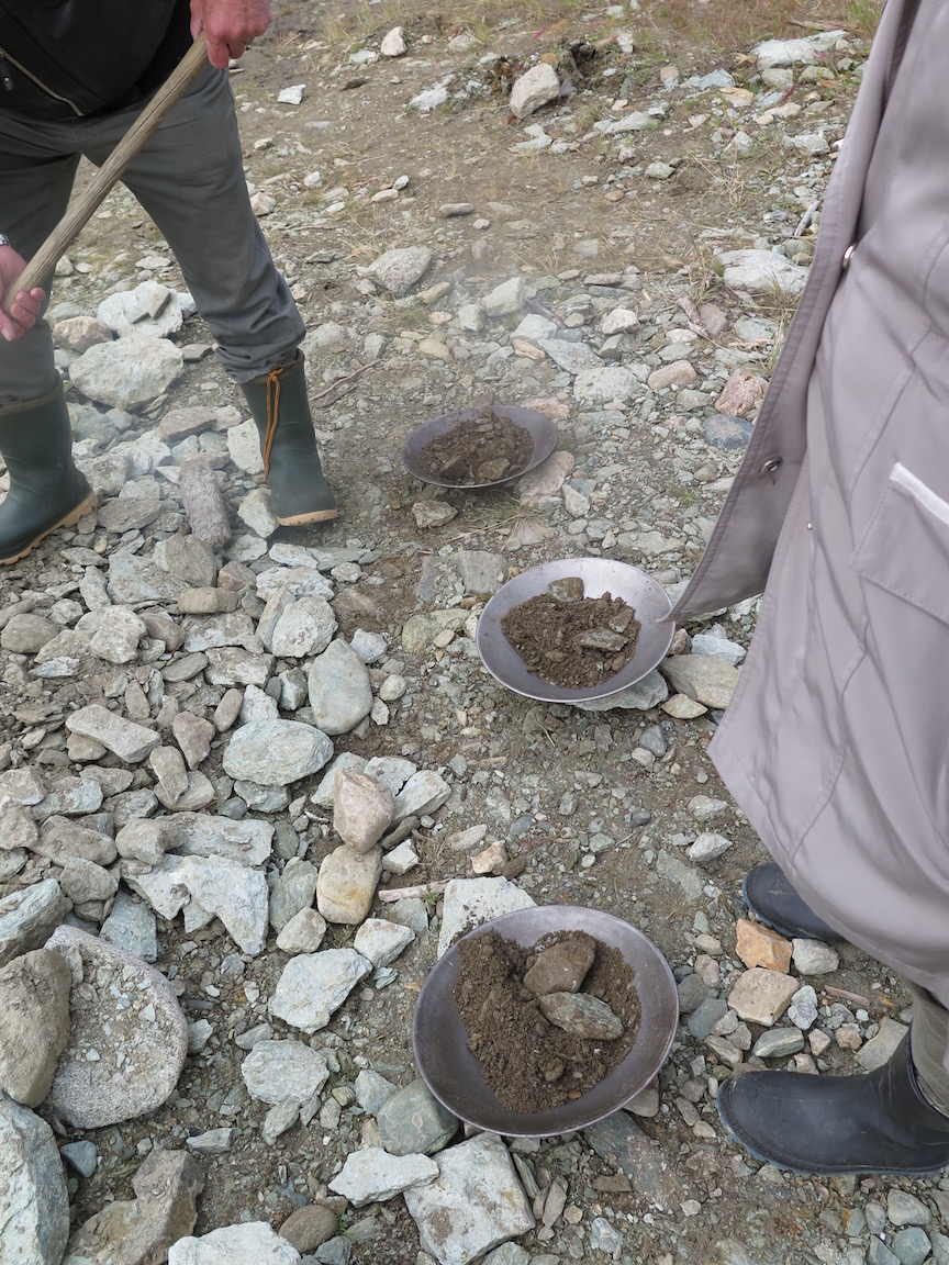
In Dawson we went out to the Gold Bottom Mine to really pan for gold. No heated water. No salted pans of gravel. We shoveled gravel from the mine run and panned in the cold stream. They have to process a lot of gravel to get the ounce of gold an hour that lets them break even. First remove the dirt with water cannons. Then run the gravel through a sluice to get concentrated ore. Then pull the gold out of the concentrate. You need to use a lot of water in the process. Gold mining is hard work. We got a few flakes for our efforts. It was a good day.


The hardware store in Dawson sells gold prospecting equipment. There is good hiking around the town. It was a fun place to visit. We even saw some wildlife.


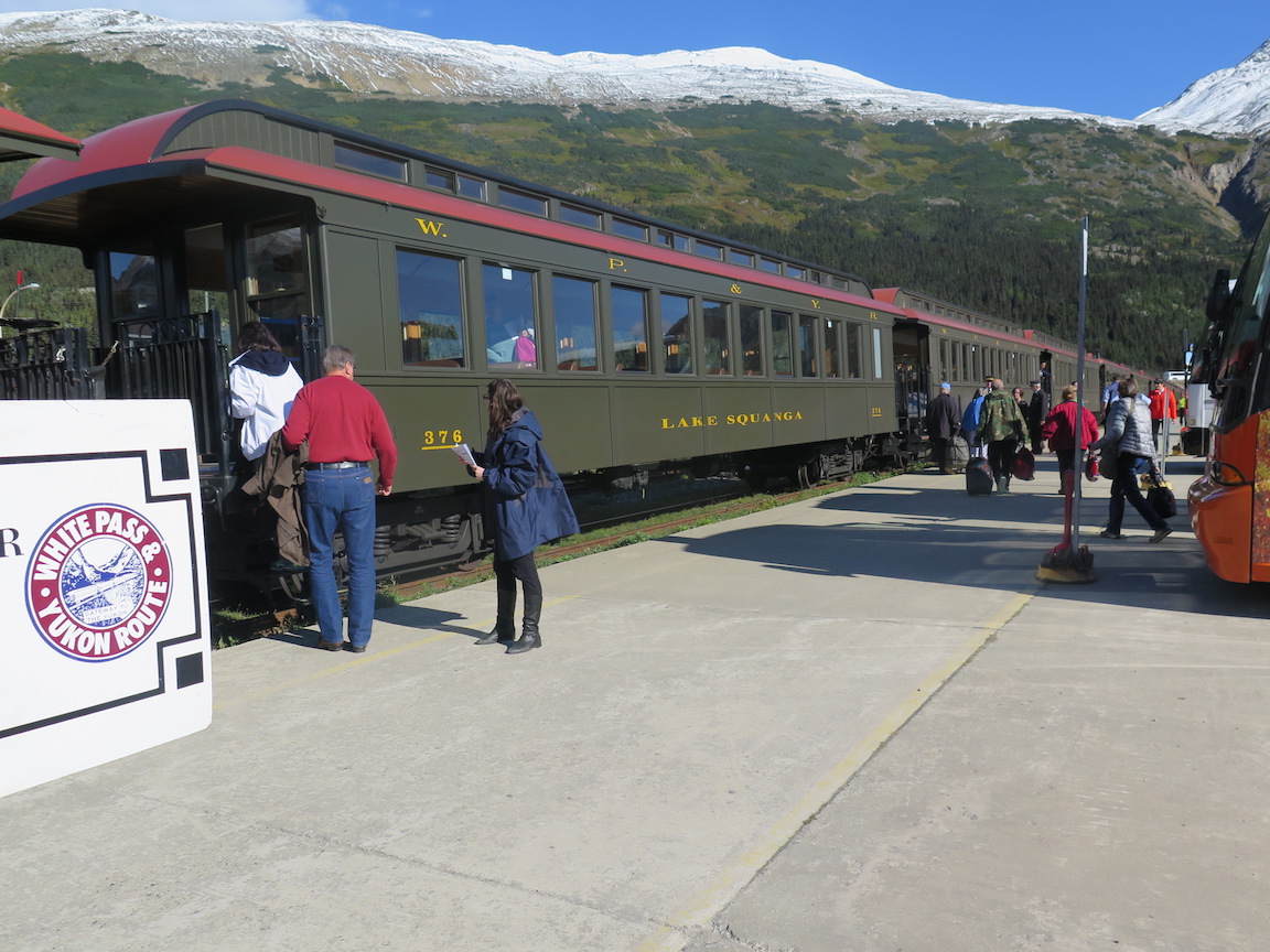
And then it was another bus ride to Whitehorse.


And a bus ride to Frasier to find the White Pass railroad.


The White Pass railroad took us to Skagway.


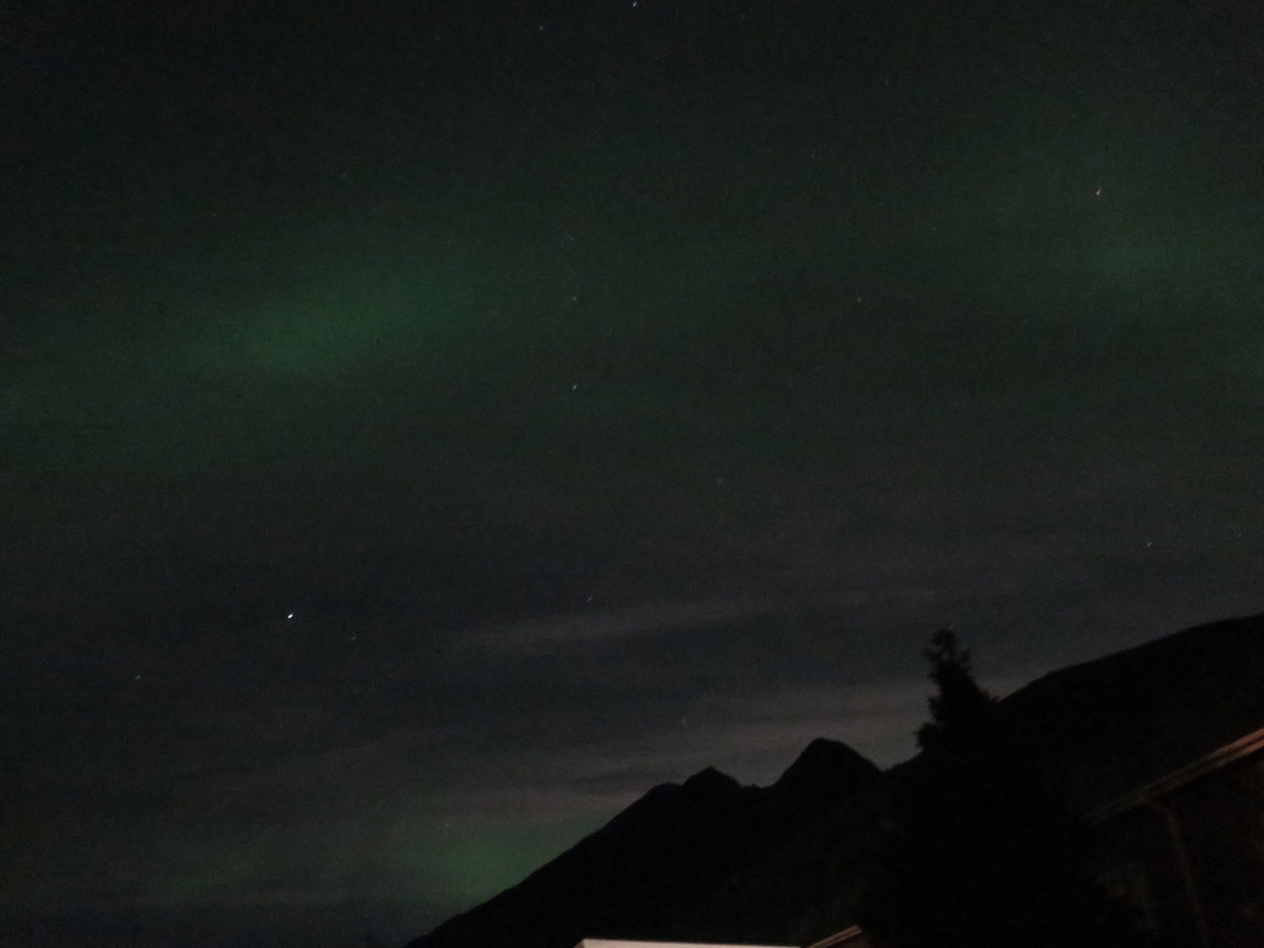
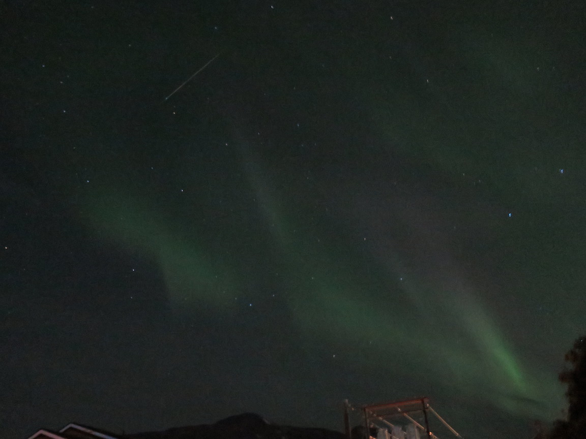
We saw the northern lights in Skagway. It was the only clear night on our trip to Alaska.


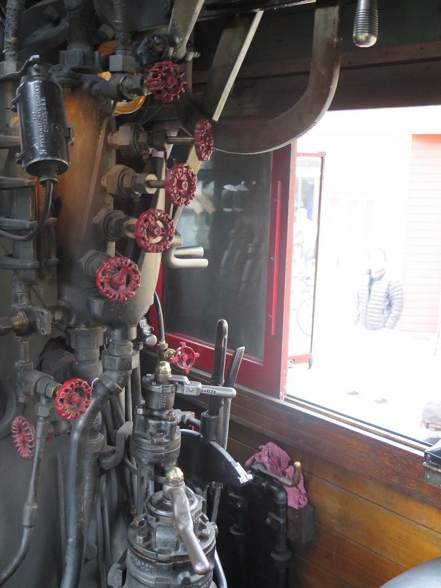
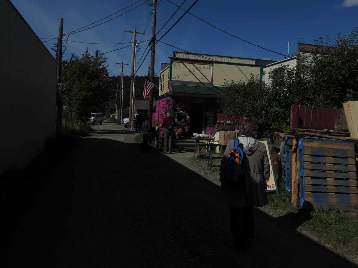
We did some hiking around Skagway, including part of the Chilkoot Trail, before getting on the cruise ship. Also got to get in the cab of the steam engine, and there was a rock shop.


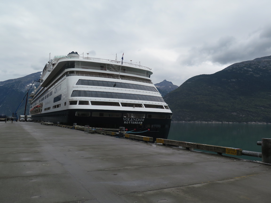
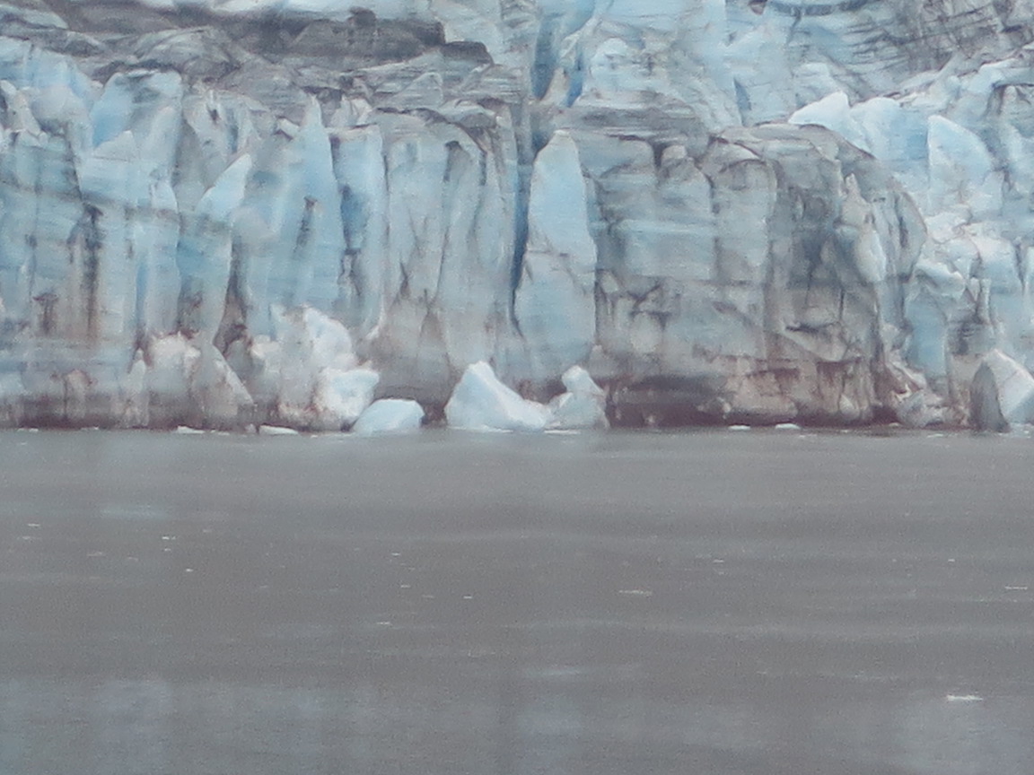
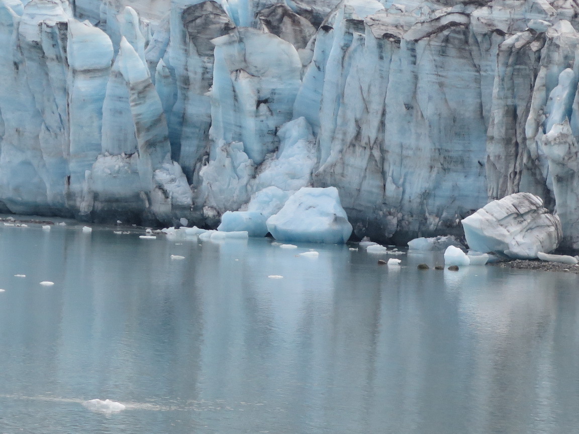
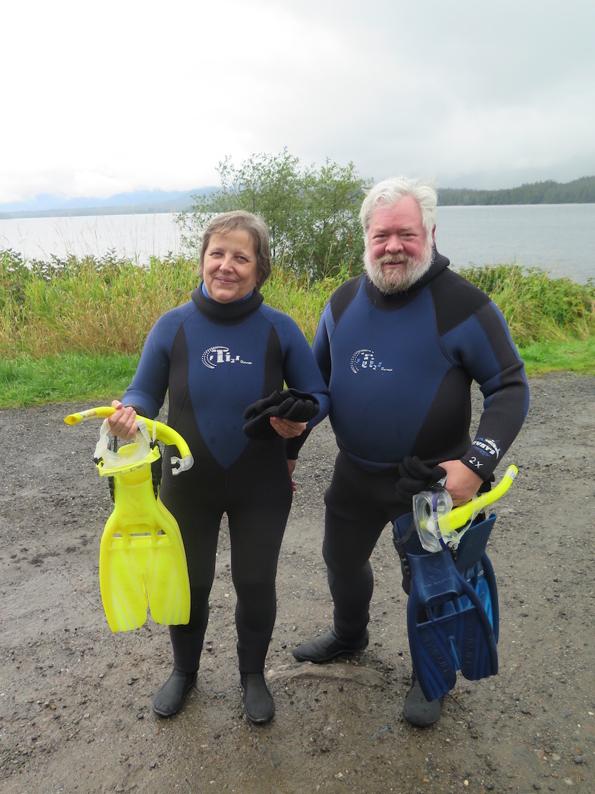
We got to see glaciers, and stopped in Ketchikan and went snorkeling. We even saw some whales. And I got a tour of the engine room on the ship. Then it was Vancouver, and time to go home.

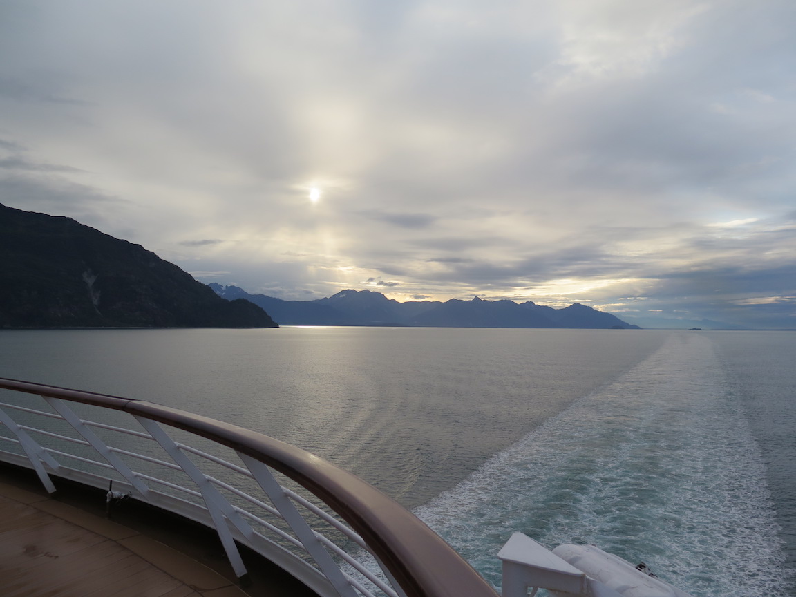


It was a wonderful trip, and a few rocks were collected.
This is not a normal collecting report, but please be tolerant and read on because rocks were collected.
Today I lugged a couple bushel baskets full of better specimens from my rock collection (individually wrapped in newspaper) to St. Francis Xavier School and spent half a day teaching second grade (I've done this for several years now). The regular teacher had prepared them through the normal geology/science sequence, and also had each student find a dozen rocks and bring them in an egg carton. I told them a bit about each of my specimens, trying to tie them to something they might know (use, location, or history). We then worked on identifying and labeling each of their rocks (magic marker numbers and labels in the lid of the egg carton).
As expected, there was a lot of limestone, marble (decorative rock usually pulled from a flower bed), some basalt, quartzite, and granite (we have a lot of glacial gravel in Grand Rapids). Being Michigan there were also several petoskey stones and horn corals, and one fist sized complete fossil coral that perfectly matched my fossil book's description and picture so I was able to name it too. I also identified a few pieces of coal, three agates, two pyrites, a clinker, a thumbnail specular hematite, ond one chunk of concrete.
One student had found a flint arrowpoint with beautiful notches and workmanship (about 1/4 inch of the tip was broken off, 7/8 inch length left) working in his family garden and had kept it because it was shiny. Another student brought in an egg size chunck with one surface covered with beautiful light amber colored topaz (I couldn't match it to anything else from hardness and crystal shape, which matched several guidebooks perfectly) he had picked up at a mine they visited while on vacation last summer; I wanted it for my collection.
Each student will be taking home a starter rock collection. I think they also took home some of my excitement for collecting rocks. I didn't bring home any new additions to my collection, but I had a wonderful time. And I might have created another rockhound to perpetuate our mutual hobby. This is something each of us needs to do. I hope my "field trip report" inspires you to collect a few pebble pups as well as tangible specimens.
I didn't expect to get to go to this trip today, that I had posted a week or so ago, but an unusual set of circumstances took me out of my previous engagement and left me home with the younger kids (13, 10, 6). So we scrounged up hammers for all, backpacks and flashlights (the battery charger got a workout), and made the mine site with 15 minutes to spare.
In 1907 the Alabastine Company started hand digging a shaft to the 12 to 20 foot thick bed of gypsum known to be under Grand Rapids, Michigan. After one year of work the mine floor depth of 85 feet was reached. It went thru 20 feet of glacial till and a thick layer of shale to reach the gypsum. Up to the time production ceased in 1943 and the company went bankrupt, just over six miles of 20 to 40 foot wide tunnels had been dug. Off the tunnels are 74 'rooms' of about 40,000 sq. ft. each. When production was started the wage was sixty cents (US) per hour, and each miner was expected to remove 14 tons a day.
The mine had an underground rail system to haul rock powered by mules that lived in the mine. The mules provided manure for the mushroom growing operation that also was in the mine for many years, but had ceased before the mine operation ended. A well was sunk in the mine an additional 75 feet down to provide water for the mules and workers. A second shaft for an elevator - the first had a wooden stairwell circling a bucket lift - was also dug while the mine was in operation.
In 1947 the Michigan Natural Storage Company purchased the 50 acre surface site and mineral rights, including the mine. They began clearing the mine and used the space for storage in the natural 50 degree (F) 80 percent humidity conditions. They have cleared about 20 percent of the mine so far, and in doing so found that most of the original tools used in working the mine had been left behind. They also have dug a second elevator shaft (each car holds 80 adults).
About 350 people (average of two kids per adult) showed up and paid $2 for adults and $1 for kids (the fee had not been included in the announcement of the trip that I passed on in my post). About an hour was spent touring the mine and receiving a lecture on the geology of the Mine, Michigan, and the gypsum formation we were in from Dr. Mary Jane Dockeray. There are actually three major gypsum beds here, and this is the upper one. The middle and lower layers are in production by two other mines in the city (no collecting access) to make wallboard. We were then given an hour access to four 40 by 700 foot rooms that had not been cleared of rubble (except for the first 10 feet or so).
The gypsum bed has alabaster for about the bottom 9 feet, then pencil selenite for about a foot, then pencil honey gypsum for a couple feet, and honey gypsum to the shale roof. Right at the roof line there is a 1/2 and 1/4 inch thick pair of seams of selenite that are almost clear enough to see thru. I did not try to collect any of the Epsomite growing from the ceiling like hair (up to 18 inches long) because it turns to powder when removed from its environment. Shark coprolites are found in the roof shale (not by me - rats), but the only piece of shale I brought back had a 3/4 inch vug lined with beautiful 1/8 and smaller selenite crystals (and several smaller vugs like it). That shale piece also appears to have a thin layer of sulphur on one end and has a thick layer of pencil selenite on the other end.
I took a backpack with my collecting shoulder bag inside so I could come out with two packs of rock. I got several nice, larger than fist sized, samples of each type of gypsum and several big chunks of (somewhat marbled) alabaster that I intend to make into spheres. I used a one inch chisel ($2 at a surplus store) and a three pound hand sledge, and took all my specimens from the mine walls. We had to work by flashlights. The rubble was mostly shale (with watermelon size and bigger chunks of gypsum imbedded), and much of that had turned to slippery clay. The rubble was in piles spanning the rooms and was from 1 to 8 ft thick.
The kids also managed to fill their backpacks. We all had a great time, all got dirty, and all worked up an apatite (I also worked up a good sweat). Gypsum may only be 2 on the Moh's Scale, but we also found an appreciation of the work it takes to mine rock.
Today I went with the St. Francis Xavier Jr. High to the Alabastine Gypsum Mine for a field trip. The mine ceased production in December, 1943 when it was forced into bankruptcy. The mine was purchased by the Kragt family in 1946 and the turned two of the six plus miles of 50 degree, 90% humidity tunnels into a storage warehouse for produce and foodstuffs as the Michigan Natural Storage Co. We had a tour of the storage areas while our guide, Marc Bruggema, explained the history and geology of the mine. The students were then turned loose with their flashlights and hammers in half of the unused part of the mine to collect specimens for half an hour or so.
The Alabastine Mining Co. started operations in the early 1800s in the Grand Rapids area. There are six layers of gypsum under the city, and the top layer actually reaches the surface west of town where mining operations started. Several sources indicate it was the first commercial gypsum mining operation in the United States. The Alabastine Mine itself was started in the early 1900s when a shaft was dug at the edge of the city to the second layer of gypsum. Miners worked a 10-12 hour day and were paid about 50 cents per ton mined (about an hour's work) and delivered to the shaft by horsedrawn rail carts; this equates to about $80/hour today and was several times what a factory worker could make.
The ceiling of the mine is dolomite, and it shows ripples, a shoreline at one point, and mud crack impressions. Under the dolomite is a layer of shale and selenite. Below that is 'pencil gypsum' (large vertical crystals of selenite) that is usually honey colored from a salt (halite) impurity and 'sugar gypsum' (alabaster) that runs from pink, thru honey, to white. This gypsum seam runs between six and twenty feet in thickness.
As one of the drivers for the trip, I had few responsibilities during the mine tour itself, and was able to collect all I wanted (which was also all I could carry) in a short time. I spent the rest of the collecting period helping kids break rock (I came prepared), answering questions, holding flashlights, and taking pictures. The unused parts of the mine have not been cleared of the rubble and muck (a mix of shale and gypsum that is wet, slippery, and sticky) left behind by the miners, and those tunnels also have no lights. More than one student ended up barefoot when their shoes got stuck in the mud and they pulled out of them trying to get free. We had fun getting dirty.
When I got home and looked at my newspaper, I found a half page story, with pictures, from another school that had taken the same trip earlier this week. If you want to see pictures, I took my camera along and have posted some of them at the href="http://SaintFrancisXavier.org/Homework/MineTrip.shtml"> School's website.
And to round out the field trip, I'm taking another vacation day next week to go back to the school with a couple bushel baskets of my rock collection to see if I can get some of these kids excited about geology before they wrap up the science unit that triggered the trip. I expect to have even more fun on that visit than I had today. If you want to have more fun than usual on your next field trip, bring along a bunch of kids.
This is not really my field trip, it is Alan Silverstein's ( ajs@hpfcajs.fc.hp.com ) . Please be patient with my short version of a long story. TLC had a program on the extinction of the dinosaurs that generated much discussion on my Rockhound and Fossil lists, including a couple from me. Alan and I got into an off-list discussion and he sent me pictures of the K/T Boundary and has promised me a sample, which I have tentativly arranged to have analyized. Watch this space -hopefully there are more chapters to come. You can click on the images to see a bigger picture too.
Alan said, I collected some in southern Colorado near Trinidad. It's VERY boring and crumbly material, only of value for what it represents...
The K/T boundary exists in MANY places, including much closer to home for me (in the foothills west of Fort Collins, CO), but it's indistinguishable in most cases without microfossil analysis or whatever. I speculate that the white band in the boundary near Trinidad resulted from a calm lake bottom where the ash settled as clay and was preserved undisturbed. And I suppose that means 2-3 cm of ash (or more?) must have fallen, to be compressed. In most places it probably just washed away or was mixed or diluted.
By the way, I was motivated to visit the site by seeing a short loop video at the Denver Museum of NH, in the Prehistoric Journey exhibit. They have a small, carefully-mounted slice through the layer, from this same location, embedded in resin I think, also on display. I heard that the Smithsonian dug out a 1' cube from here.
I contacted the highway dept, and they said, sure, feel free to collect, and let us know if we need to clean up after you. I gathered up some of the 1 cm thick, iridium-rich white layer while down near Trinidad a couple of years ago. Like I said, it's not very exciting stuff. It's also VERY fragile, about impossible to remove a cross-section intact, all you end up with is clods of dry gray mud (that break up further if you breath on them).
 The source is in a roadcut east of I-25, south of Trinidad, Colorado, above the frontage road. The roadcut reveals a horizontal stripe of white clay in gray/brown clay that runs for at least a hundred feet visibly. I collected on May 10, 1996.
 This view of K/T boundary exposure along I-25, at about mile marker 8, south of Trinidad, CO (at about 3:30pm on 960510) contains a US nickel coin to give scale. The white clay occurs in gray-brown clay, but there's also lots of shaley stuff, especially on both sides of the white band.
 When I collected this stuff, I asked around (a little), but was unable to find anyone with a mass-spec who wanted to confirm the iridium content. One guy to whom I sent samples did report microscopically viewing shocked quartz grains and/or melted spherules.
If you would like to learn more about the K-T boundry and the extinction
event, visit this link from my Rockhounds page:
Where did all the dinosaurs go?
The K-T Boundary
8 Sep 2000 update - the sample arrived in good condition and I hope to get it into the lab this week.
10 Sep 2000 update - I got an email, and my friend in the lab has left town, so the sample probably won't get in until next Friday, when he is scheduled to return (or more likely, the following Monday). Can't win īem all.
15 Sep 2000 update - lab equip unavail for a while
15 Oct 2000 update - I'm unavail for a while
15 Nov 2000 update - friend unavail for a while
15 Dec 2000 update - lab equip unavail for a while - Y2K special testing. Maybe January
24 Jan 2001 update - identified who needs to give permission and am discussing project with them.
11 Feb 2001 update - permissions granted - the specimen is in the lab
23 Jun 2001 update - specimens returned from lab. They believe there is iridium in the specimens, but it is less than 10 ppm, which is their level of confidence.
The lab results
 The specimens themselves

Last Monday I used a vacation day and collecting was done. . .but I didn't get to bring anything home except memories. I spent a day with a second grade class where each student had collected twelve rocks (in an egg carton) and worked with them on identifying and labeling what they had found. This is something I have done for years and its really a fun day for me.
I did haul in a couple bushel baskets full of wrapped rocks from my collection and spent a while showing them off. I tried to tie each mineral to something it was used for that the kids would know about as well as touch in its general geology. I included examples of the common minerals found in the area too.
We then set ourselves to the task of trying to identify what the kids had found. After the common rocks were identified I started to work on the exceptions. A few required guidebooks, streak tests, and a hardness kit. Amazing what kids can find in their city neighborhood.
Almost everyone had a specimen of gypsum or selenite. Not suprising since the class had gone to the Alabastine Gypsum Mine for a field trip. We had a lot of limestone and granite and marble, some chert, and a couple chunks of concrete. Some of the suprises this year included vugs containing crystals of quartz, calcite, or zeolites (and I wouldn't have minded having a couple of them for my collection), and almost three-quarters of a garnet crystal that was almost 1 1/2 inches across with perfect faces. A few nice agates and fossils rounded it off.
We ended up the day by looking at crystal shapes and connecting it to their current math unit on shapes (rectangle, square, triangle, rhombus, etc.). Being able to show them real life examples of the shapes they had been studying was exciting. Second graders are great fun to watch as concepts connect to reality.
I had fun, the kids had fun, rocks were collected. Hopefully someone had a memorable experience (besides me) and will turn into a rockhound.
I'm filing this trip report in hopes it will inspire others to find a local school and share their expertise and collection. We all have a responsibility to make sure there is another genration of Rockhounds.
It is often easier (and cheaper) to mail collected specimens home than travel with them. Many delivery services will allow you to use your home address as both the TO and FROM address. Use a local newspaper from the collecting area in packing to assist you in identifying the specimens when you return home. Make arrangements before you leave to have mail and packages collected for your return.
If you are mailing across national boundaries you need a customs code. Per the Harmonized Tariff Schedule of the United States (2003) you probably should specify 9705.00.00.90 -- Collections and collectors' pieces of zoological, botanical, mineralogical, anatomical, historical, archeological, paleontological, ethnographic or numismatic interest, Other. This may also be specified as 9705-0000 (mineral specimens for identification, negligable caxh value).
BTW, crossing national borders may invoke a (vat) tax on the sender and/or recipient based on declared or estimated value of the specimens. Many suggest including only an identifying number with each specimen, and mailing all identification and supporting paperwork independently. You may want to contact local rockhounds or dealers for advice in mailing to your home country.
Pack your specimens securely. Specimens that can rattle around will be damaged in shipment. At a minimum, wrap each specimen in a full sheet of newspaper. Consider multiple layers: specimen, thin plastic wrap, toilet paper wrap, tissue paper wrap, foam wrap, packing peanuts, box, more packing peanuts, box. Crumpled and packed newspaper works in place of packing peanuts. Very fine specimens may need to be packed into a box with laundry soap (as very small packing peanuts), sealed, and then packed as a specimen. Nothing should move when you shake the sealed package. Tape all edges and over the labels.
The Colorado School of Mines and collecting around the Denver Area
The Millard Chandler (North Star) Mine
The Porcupine Mountains Wilderness State Park part 1
The Porcupine Mountains Wilderness State Park part 2
The Porcupine Mountains Wilderness State Park part 3
You can return to The Tomaszewski Family Public Home Page, or visit my personal homepage for more Rockhounding information, or check out my collection of links for rockhounds, or read about Labeling and Cataloging Rocks, Minerals, and Fossils, or view some specimens from my collection, or learn how to make your own lapidary equipment, or send me Email at Kreigh@Tomaszewski.net